Odin, Kansas facts for kids
Quick facts for kids
Odin, Kansas
|
|
|---|---|

|
|
| Country | United States |
| State | Kansas |
| County | Barton |
| Area | |
| • Total | 4.0 sq mi (10.4 km2) |
| • Land | 4.0 sq mi (10.4 km2) |
| • Water | 0 sq mi (0.0 km2) |
| Elevation | 1,844 ft (562 m) |
| Population
(2020)
|
|
| • Total | 87 |
| • Density | 21.67/sq mi (8.37/km2) |
| Time zone | UTC-6 (CST) |
| • Summer (DST) | UTC-5 (CDT) |
| Area code | 620 |
| FIPS code | 20-52175 |
| GNIS ID | 475528 |
Odin is a small community in Barton County, Kansas, United States. It is called a census-designated place (CDP). This means it is a specific area that the government counts for population information.
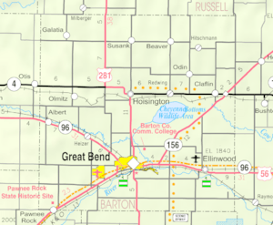
As of the 2020 census, 87 people lived in Odin. You can find Odin northwest of Claflin. It is located where NE 140 Rd and NE 90 Ave meet.
Contents
History of Odin
Odin once had its own post office. The first post office opened in 1877. It closed in 1906.
The post office was opened again in 1950. However, it finally closed for good in 1995.
Geography of Odin
According to the United States Census Bureau, Odin covers a total area of about 10.4 square kilometers (or 4 square miles). Most of this area is land.
Only a very small part, about 0.02 square kilometers, is water. This means Odin is mostly land.
People and Population
This section shares facts about the people who live in Odin. It includes information from the United States census.
| Historical population | |||
|---|---|---|---|
| Census | Pop. | %± | |
| 2010 | 101 | — | |
| 2020 | 87 | −13.9% | |
| U.S. Decennial Census | |||
Population in 2020
The 2020 United States census counted 87 people living in Odin. These people lived in 38 households. There were 27 families among them.
All 87 people counted were white. No other racial groups were reported in Odin at that time.
Households and Families
Of the 38 households, about 34% had children under 18 years old. Most households, about 63%, were married couples living together. About 10% of households had a female head without a spouse.
Nearly 29% of households were made up of single individuals. About 13% of households had someone living alone who was 65 years old or older. The average household had 2.1 people. The average family had 4.1 people.
Age and Education
About 24% of the people in Odin were under 18 years old. About 17% were 65 years old or older. The average age in Odin was 40.5 years.
About 16% of the population had a college degree or higher.
Education in Odin
The public schools in Odin are part of the Central Plains USD 112 school district.
The schools in Odin closed in 1974. This happened because of a school unification plan. The high school in Odin used to have a mascot called the Odin Tigers.
See also
 In Spanish: Odin (Kansas) para niños
 | William M. Jackson |
 | Juan E. Gilbert |
 | Neil deGrasse Tyson |


