Ouapitagone Archipelago facts for kids
|
Native name:
Archipel de Ouapitagone
|
|
|---|---|
| Geography | |
| Location | Gulf of Saint Lawrence |
| Coordinates | 50°11′44″N 60°16′47″W / 50.195556°N 60.279722°W |
| Administration | |
|
Canada
|
|
| Province | Quebec |
| Region | Côte-Nord |
| RCM | Le Golfe-du-Saint-Laurent |
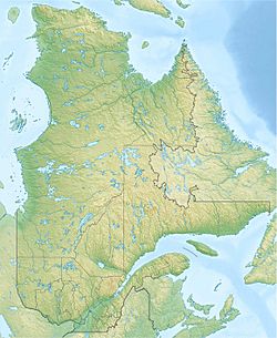
The Ouapitagone Archipelago (which is Archipel de Ouapitagone in French) is a small group of rocky islands. You can find them in the province of Quebec, Canada. These islands are located off the Côte-Nord (North Shore) area of the Gulf of Saint Lawrence.
Contents
Where Are the Ouapitagone Islands?
These islands are part of the Côte-Nord-du-Golfe-du-Saint-Laurent municipality. This area is in the Le Golfe-du-Saint-Laurent Regional County Municipality. The islands and rocks act like a natural shield, protecting Ouapitagone Harbour and the Ouapitagone Strait.
Main Islands and Rocks
The group includes several important islands. The biggest one is Ouapitagone Island itself. Other islands are Lac Island and the Ouapitagone du Large Islands. There are also smaller rocky spots called the Cormoran Rocks. The name of these islands is even used for a local area called the canton of Archipel-de-Ouapitagone.
Natural Features and History
The islands are close to where the Étamamiou River meets the sea. They are mostly made of tall, hard granite rocks. For many years, local fishermen have visited these islands. They came to catch lots of wolffish, which are a type of fish. In the past, sailors also stopped at these islands to get fresh water.
What Does "Ouapitagone" Mean?
The islands were first mentioned way back in 1535 by Jacques Cartier. He called them the "Ysles Sainct Germain." Over time, their name changed on different maps. In 1744, a map by Bellin called them "Ouapitougan." Later, in 1877, a map by H. W. Bayfield showed them as "Wapitagun." Other names like Wapeetougone, Wapitagone, and Jupitagun have also been used.
Possible Meanings of the Name
There are a few ideas about where the name Ouapitagone comes from. Some people think it comes from the Innu language word Shushupitagon. This word means "whetstone," which is a tool used to sharpen knives.
Another idea is that Ouapitagone might be the name of a rare white-winged cormorant. Cormorants are birds that dive for fish. Or, it could mean "place marked by the white droppings of cormorants." The Innu people in the area have their own name for the Ouapitagone du Large island. They call it Matshatihk Kaiapit Ministukua, which means "Island of the deformed caribou."
If you travel between Point Sealnet and Ouapitagone Island, which is about 10 miles (16 km) to the southwest, you'll see many small islands and rocks. These stretch out about 2 miles (3.2 km) from the shore.
Challenges for Boats
Only small boats can safely travel in these waters. The people on the boat must know the Ouapitagone Archipelago very well. This is because there are many hidden rocks and shallow spots.
Important Markers
The Cormoran Rocks are about 1.8 miles (2.9 km) from Ouapitagone Island. There is a light on a tower there to help guide boats. Small boats can drop anchor in Ouapitagone Harbour. This harbor is located between Ouapitagone Island and the islands further out. However, you still need local knowledge to get through the two entrances safely.
Unique Features
The south side of Lac Island has steep, red, rocky cliffs. These cliffs are more than 30 meters (98 feet) high. They have been stained white over time by the many seabirds that live there.
 | Precious Adams |
 | Lauren Anderson |
 | Janet Collins |


