Pícaro facts for kids
Quick facts for kids Rogue River |
|
|---|---|

Río Pícaro
|
|
|
Location within Algeciras
|
|
| Country | Spain |
| Autonomous Region | Andalusia |
| Physical characteristics | |
| Main source | Sierra del Bujeo/Sierra del Algarrobo |
| River mouth | Playa de Getares, Algeciras, Spain. 36°06′N 5°27′W / 36.100°N 5.450°W |
| Length | 7.7 KM |
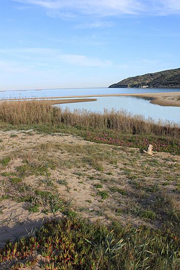
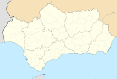
The Río Pícaro is a small but interesting river located in the southeastern part of Andalusia, a beautiful region in southern Spain. It's not a very long river, flowing for about 7.7 kilometers (that's about 4.8 miles). This river starts high up in the mountains and makes its way to the sea.
Where the River Flows
The journey of the Río Pícaro begins in the Sierra del Bujeo and Sierra del Algarrobo mountain ranges. These mountains are known for their rugged and wild landscapes. From there, the river flows downhill, carving its path through the terrain.
Its journey ends when it reaches the Bay of Algeciras. This bay is part of the larger Strait of Gibraltar, which connects the Atlantic Ocean and the Mediterranean Sea. The river's mouth is near the city of Algeciras, at a place called Playa de Getares.
Why "Rogue" River?
The name "Pícaro" is a Spanish word that means "rogue" or "mischievous." This name perfectly describes the river's path. The land it flows through is very rugged and uneven. This means the river doesn't have a smooth, easy journey.
Instead, it twists and turns through difficult terrain, much like a "rogue" might wander through wild lands. This gives the river a unique character, reflecting the challenging landscape it travels through.
See also
 In Spanish: Río Pícaro para niños
 | Calvin Brent |
 | Walter T. Bailey |
 | Martha Cassell Thompson |
 | Alberta Jeannette Cassell |


