Palomas, Comerío, Puerto Rico facts for kids
Quick facts for kids
Palomas
|
|
|---|---|
|
Barrio
|
|

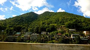
Sector La Cascada in Palomas
|
|

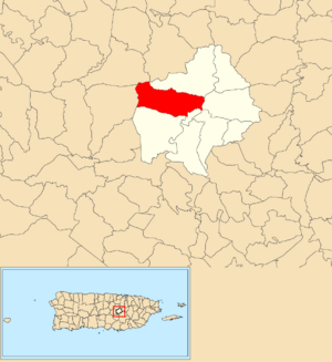
Location of Palomas within the municipality of Comerío shown in red
|
|
| Commonwealth | |
| Municipality | |
| Area | |
| • Total | 3.97 sq mi (10.3 km2) |
| • Land | 3.96 sq mi (10.3 km2) |
| • Water | 0.01 sq mi (0.03 km2) |
| Elevation | 1,742 ft (531 m) |
| Population
(2010)
|
|
| • Total | 4,719 |
| • Density | 1,191.7/sq mi (460.1/km2) |
| Source: 2010 Census | |
| Time zone | UTC−4 (AST) |
Palomas is a community, also known as a barrio, located in the town of Comerío, Puerto Rico. In 2010, about 4,719 people lived there. It is a part of the beautiful island of Puerto Rico.
Contents
Exploring Palomas: What are Sectors?
Communities in Puerto Rico, like Palomas, are often divided into smaller areas. These smaller parts are called sectores (say: sek-TOR-es). Think of them like neighborhoods within a larger community.
Types of Sectors in Palomas
Sectors can have different names depending on what they are like. Some are simply called "sector," while others might be named "urbanización" (a planned housing area) or "reparto" (a land division).
Here are some of the sectors you can find in Palomas:
- Condominios Brisas de la Sierra
- Egda. Golden Living
- Las Bocas
- Palomas Abajo
- Parcelas Nuevas y Viejas
- Parts of Carretera 780
- Sector Caimito
- Sector Calderón
- Sector Capilla
- Sector Concho
- Sector El Guareto
- Sector El Mangó
- Sector Escuela
- Sector La Prá
- Sector Los Chuchitos
- Sector Los Liberales
- Sector Los Oyola
- Sector Los Vidrios
- Sector Manuel Espina
- Sector Manuel Reyes
- Sector Negrón (R-809)
- Sector Ortiz
- Sector Padilla
- Sector Quiles
- Sector Rincón
- Sector Romero
- Sector Solís
- Sector Zamora
- Urbanización San Andrés
- Vuelta del Dos
A Look Back: The History of Palomas
Puerto Rico has a rich history. After the Spanish–American War, Spain gave Puerto Rico to the United States. This happened under an agreement called the Treaty of Paris of 1898. Puerto Rico then became a territory of the United States.
Population Changes Over Time
In 1899, the United States government counted everyone living in Puerto Rico. This count, called a census, showed that 1,091 people lived in Palomas barrio. Over the years, the population has changed, as you can see in the table below.
| Historical population | |||
|---|---|---|---|
| Census | Pop. | %± | |
| 1900 | 1,091 | — | |
| 1910 | 1,260 | 15.5% | |
| 1920 | 1,995 | 58.3% | |
| 1930 | 3,158 | 58.3% | |
| 1940 | 3,915 | 24.0% | |
| 1950 | 2,809 | −28.3% | |
| 1980 | 3,230 | — | |
| 1990 | 4,666 | 44.5% | |
| 2000 | 4,382 | −6.1% | |
| 2010 | 4,719 | 7.7% | |
| U.S. Decennial Census 1899 (shown as 1900) 1910-1930 1930-1950 1980-2000 2010 |
|||
See also
 In Spanish: Palomas (Comerío) para niños
- List of communities in Puerto Rico
 | William Lucy |
 | Charles Hayes |
 | Cleveland Robinson |


