Palpa, Peru facts for kids
Quick facts for kids
Palpa
Palpa
|
|
|---|---|
|
Town
|
|

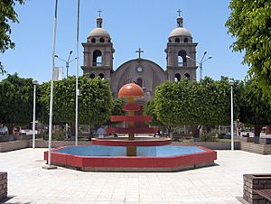
Palpa Armas Square (Plaza de Armas en Palpa)
|
|
| Country | |
| Region | Ica |
| Province | Palpa |
| District | Palpa |
| Demonym | Palpena(o) |
| City Established | December 27, 1963 |
| Elevation | 347 m (1,138 ft) |
| Time zone | UTC-5 (PET) |
Palpa is a town located in southern Peru. It is the main town, or capital, of the Palpa Province in the Ica Region. Palpa was officially established as a city on December 27, 1963.
Contents
Exploring Palpa's Ancient History
The area around Palpa is full of amazing old places called archeological sites. These sites show us how people lived long, long ago. Some of them are from the very old Archaic Period. Others are from closer to when the Incan Empire started to decline.
Important Archeological Sites Near Palpa
Many of these ancient sites are quite close to the town of Palpa. This makes Palpa a central spot for exploring history. Some of the important sites include:
- Pernil Alto
- Huayuri
- Pinchago Bajo and Pinchago Alto
- Mollake Chico
- PAP-294
- PAP-365
- PAP-64A and PAP-64B
- Juaranga
- Los Molinos
- Estaqueria
- La Muña
- El Arenal
- Chillo
- Parasmarca
- PAP-379
When you see "Alto" in a site's name, it means the higher part of that place. "Bajo" means the lower part.
Discovering Clues from the Past
At these sites, archeologists find many old things, like pieces of pottery called ceramics. These artifacts help them figure out how old the sites are. They also show which ancient groups of people lived there.
Some of these sites are hard to reach because of mountains and deep valleys. Rivers have carved these valleys over many years. Because of this, new ways of exploring have been developed. One cool new method is using 3D Modeling. This helps scientists study the sites without even being there in person.
Palpa's Climate and Weather
Palpa has a very warm and dry climate. It is located about 347 meters (1,138 feet) above sea level. The weather is generally sunny throughout the year.
Temperature in Palpa
The temperatures in Palpa are usually quite high. The hottest months are from January to March, with daily highs often reaching over 34 degrees Celsius (93 degrees Fahrenheit). Even in the cooler months, like July and August, the daytime temperatures are still warm, around 27-28 degrees Celsius (81-82 degrees Fahrenheit).
Nights are cooler, especially from May to August. The coolest nights are in July and August, sometimes dropping to about 8 degrees Celsius (46 degrees Fahrenheit).
Rainfall in Palpa
Palpa gets very little rain. Most months have almost no rainfall at all. The wettest months are January and February, but even then, it's only a tiny amount. This means Palpa has a desert-like climate.
| Climate data for Palpa, elevation 340 m (1,120 ft), (1991–2020) | |||||||||||||
|---|---|---|---|---|---|---|---|---|---|---|---|---|---|
| Month | Jan | Feb | Mar | Apr | May | Jun | Jul | Aug | Sep | Oct | Nov | Dec | Year |
| Mean daily maximum °C (°F) | 34.2 (93.6) |
34.7 (94.5) |
34.8 (94.6) |
33.4 (92.1) |
31.1 (88.0) |
28.3 (82.9) |
27.5 (81.5) |
28.6 (83.5) |
30.4 (86.7) |
31.7 (89.1) |
32.6 (90.7) |
33.6 (92.5) |
31.7 (89.1) |
| Mean daily minimum °C (°F) | 19.2 (66.6) |
19.9 (67.8) |
18.9 (66.0) |
16.3 (61.3) |
12.4 (54.3) |
9.9 (49.8) |
8.2 (46.8) |
8.2 (46.8) |
9.8 (49.6) |
11.8 (53.2) |
13.2 (55.8) |
16.6 (61.9) |
13.7 (56.7) |
| Average precipitation mm (inches) | 2.7 (0.11) |
1.7 (0.07) |
0.7 (0.03) |
0.1 (0.00) |
0.1 (0.00) |
0.1 (0.00) |
0.1 (0.00) |
0.1 (0.00) |
0.1 (0.00) |
0.1 (0.00) |
0.0 (0.0) |
0.2 (0.01) |
6 (0.22) |
| Source: National Meteorology and Hydrology Service of Peru | |||||||||||||
See also
 In Spanish: Palpa para niños
 | Aaron Henry |
 | T. R. M. Howard |
 | Jesse Jackson |


