Panola, Oklahoma facts for kids
Quick facts for kids
Panola, Oklahoma
|
|
|---|---|
| Country | United States |
| State | Oklahoma |
| County | Latimer |
| Area | |
| • Total | 1.13 sq mi (2.92 km2) |
| • Land | 1.12 sq mi (2.90 km2) |
| • Water | 0.01 sq mi (0.02 km2) |
| Elevation | 642 ft (196 m) |
| Population
(2020)
|
|
| • Total | 73 |
| • Density | 65.12/sq mi (25.13/km2) |
| Time zone | UTC-6 (Central (CST)) |
| • Summer (DST) | UTC-5 (CDT) |
| FIPS code | 40-56950 |
| GNIS feature ID | 1096396 |
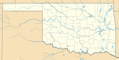
Panola is a small community located in Latimer County, Oklahoma. It is known as an "unincorporated community" because it doesn't have its own local government like a city or town. It's also a "census-designated place," which means the U.S. Census Bureau counts its population separately. In 2020, 73 people lived in Panola.
Contents
History and Name
The post office in Panola was officially opened on March 18, 1911. The name Panola comes from the Choctaw language. In Choctaw, "Panola" means "cotton." This name connects the community to the history and culture of the Choctaw people in the area.
Historic Buildings
Panola is home to some important historical buildings. The high school and its gymnasium are special because they are listed on the National Register of Historic Places. This means they are recognized for their historical or architectural importance. Being on this list helps protect these buildings for future generations.
Population Information
How Panola's Population is Counted
Like all places in the United States, Panola's population is counted regularly. This counting is done by the U.S. Census Bureau. It helps us understand how communities are growing or changing over time.
| Historical population | |||
|---|---|---|---|
| Census | Pop. | %± | |
| 2020 | 73 | — | |
| U.S. Decennial Census | |||
 | Shirley Ann Jackson |
 | Garett Morgan |
 | J. Ernest Wilkins Jr. |
 | Elijah McCoy |


