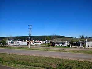
Paso Bonilla facts for kids
Quick facts for kids
Paso Bonilla
|
|
|---|---|
|
Village
|
|
 |
|
| Country | |
| Department | Tacuarembó Department |
| Population
(2011)
|
|
| • Total | 510 |
| Time zone | UTC -3 |
| Postal code |
45011
|
| Dial plan | +598 463 (+5 digits) |
Paso Bonilla is a small village in the Tacuarembó Department of central Uruguay. It's a place where people live, like a small town.
Location and Surroundings
Paso Bonilla is found where two important roads meet: Route 5 and Route 59. This spot is about 10 kilometers (about 6 miles) south of Tacuarembó, which is the main city of the department.
Just a little north of the village, about 1.5 kilometers away, is a place also called "Paso Bonilla." This name refers to the bridge on Route 5 that crosses over a small river called the Arroyo Tranqueras.
Village Population
In 2011, Paso Bonilla had a population of 510 people. The number of people living in the village has changed quite a bit over the years.
| Year | Population |
|---|---|
| 1963 | 74 |
| 1975 | 368 |
| 1985 | 743 |
| 1996 | 286 |
| 2004 | 445 |
| 2011 | 510 |
This information comes from the National Institute of Statistics of Uruguay.
More Information
 In Spanish: Paso Bonilla for kids

All content from Kiddle encyclopedia articles (including the article images and facts) can be freely used under Attribution-ShareAlike license, unless stated otherwise. Cite this article:
Paso Bonilla Facts for Kids. Kiddle Encyclopedia.

