Pat River facts for kids
Quick facts for kids Pat River |
|
|---|---|

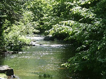
Weedon steam downstream from Vaseux Lake.
|
|
| Native name | Rivière à Pat |
| Country | Canada |
| Province | Quebec |
| Region | Estrie |
| MRC | Le Haut-Saint-François Regional County Municipality |
| Municipality | Sainte-Élizabeth-de-Warwick, Sainte-Séraphine and Sainte-Clotilde-de-Horton |
| Physical characteristics | |
| Main source | Agricultural streams Sainte-Élizabeth-de-Warwick 118 m (387 ft) 45°52′35″N 72°06′45″W / 45.876523°N 72.112423°W |
| River mouth | Nicolet Southwest River Sainte-Clotilde-de-Horton 83 m (272 ft) 45°57′52″N 72°14′07″W / 45.96444°N 72.23528°W |
| Length | 18.4 km (11.4 mi) |
| Basin features | |
| Progression | Nicolet Southwest River, Nicolet River, St. Lawrence River |
| Tributaries |
|
The Rivière à Pat (which means Pat River in English) is a smaller river that flows into the Nicolet Southwest River. It joins the Nicolet Southwest River from its east side. This river flows through several towns in Quebec, Canada. These towns are Sainte-Élizabeth-de-Warwick, Sainte-Séraphine, and Sainte-Clotilde-de-Horton. It is located in the Arthabaska Regional County Municipality (MRC) within the Estrie region.
Contents
Where Does the Pat River Flow?
The Pat River is part of a larger network of rivers. It flows into the Nicolet Southwest River. This river then joins the Nicolet River, which eventually flows into the mighty St. Lawrence River.
Pat River's Journey
The Pat River starts from small streams in the town of Sainte-Élizabeth-de-Warwick. This area is very close to the town of Kingsey Falls.
From its beginning, the Pat River travels about 18.4 kilometres (11.4 mi) (about 11.4 miles). Here is how its journey unfolds:
- It flows about 3.7 kilometres (2.3 mi) (2.3 miles) northwest through Sainte-Élizabeth-de-Warwick.
- Then, it goes about 4.8 kilometres (3.0 mi) (3 miles) north. It passes about 2.2 kilometres (1.4 mi) (1.4 miles) east of the village of Sainte-Séraphine.
- Next, it travels another 4.8 kilometres (3.0 mi) (3 miles) northwest until it reaches the border of Sainte-Clotilde-de-Horton.
- Finally, it flows about 5.1 kilometres (3.2 mi) (3.2 miles) west to where it meets the Nicolet Southwest River.
Nearby Waterways
The Pat River is surrounded by other rivers and streams. These include:
- To the north: The Nicolet Southwest River and the Nicolet River.
- To the east: The Nicolet River and the rivière des Rosiers.
- To the south: Léon-Gélinas stream and Dubuc stream.
- To the west: The Nicolet Southwest River.
The Pat River joins the Nicolet Southwest River on its east side. This meeting point is about 1.6 kilometres (0.99 mi) (1 mile) upstream from a place called Île Lemire. It is also upstream from the village of Sainte-Clotilde-de-Horton.
What Does "Rivière à Pat" Mean?
The name "Rivière à Pat" was officially recognized on September 5, 1985. This was done by the Commission de toponymie du Québec, which is like a special committee that names places in Quebec.
 | Delilah Pierce |
 | Gordon Parks |
 | Augusta Savage |
 | Charles Ethan Porter |

