Nicolet River facts for kids
Quick facts for kids Nicolet River |
|
|---|---|

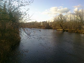
Nicolet River in Kingsey Falls
|
|
| Native name | Rivière Nicolet |
| Country | Canada |
| Province | Quebec |
| Region | Centre-du-Québec |
| MRC | Nicolet-Yamaska Regional County Municipality |
| Physical characteristics | |
| Main source | Lake Nicolet Saints-Martyrs-Canadiens 350 metres (1,150 ft) 45°49′19″N 71°35′33″W / 45.82206°N 71.59259°W |
| River mouth | Lake Saint Pierre Nicolet 5 metres (16 ft) 46°15′09″N 72°39′09″W / 46.2526°N 72.6524°W --> |
| Length | 137 km (85 mi) |
| Basin features | |
| Progression | St. Lawrence River |
| River system | Saint Lawrence River |
| Basin size | 3,380 km2 (1,310 sq mi) |
| Tributaries |
cours d'eau Nolin, ruisseau Morin, ruisseau Turgeon, décharge du lac à la Truite.
|
The Nicolet River (French: Rivière Nicolet) is a cool river in Quebec, Canada. It flows into Lake Saint Pierre, which then connects to the mighty Saint Lawrence River. The river got its name from a famous explorer named Jean Nicolet.
Many smaller rivers flow into the Nicolet, like the Bulstrode River and the Nicolet Southwest River. Most of the land drained by the Nicolet River is in the Centre-du-Québec region. The city of Nicolet is located right where the river meets Lake Saint Pierre.
Contents
Exploring the Nicolet River
Where the River Starts and Ends

The Nicolet River starts its journey at Lake Nicolet in Saints-Martyrs-Canadiens. This is about 137 kilometres (85 mi) (about 85 miles) away! The lake is quite high up, around 350 metres (1,150 ft) (1,150 feet) above sea level.
From there, the river flows northwest. It finally reaches Nicolet and empties into Lake Saint Pierre.
The River's Drainage Area
The area of land that drains into the Nicolet River is called its watershed. This watershed covers a huge area of 3,380 kilometres (2,100.23 mi) (about 1,300 square miles).
Many smaller rivers and streams join the Nicolet. Some of the most important ones are the des Vases, des Pins, des Rosiers, Bulstrode, and Nicolet Southwest. The Nicolet Southwest River is especially big, draining half of the entire watershed!
The Nicolet River basin also has 40 lakes. The biggest ones are Lake Nicolet (covering 401 hectares (990 acres) or 991 acres), les Trois Lacs (Les Sources) (225 hectares (560 acres) or 556 acres), and the Beaudet reservoir (88 hectares (220 acres) or 217 acres).
Rocks and Land Around the River
The land around the Nicolet River changes as you go along its path. The upper part of the river, upstream from Saint-Léonard-d'Aston, is part of the Appalachian Mountains. Here, the ground is made of different kinds of rocks. You can find sedimentary rocks like shale, slate, and sandstone. There are also volcanic rocks like basalt and special rocks like Serpentine.
Downstream from Saint-Léonard-d'Aston, the land is part of the St. Lawrence Lowlands. The rocks here are also sedimentary, including schist, dolomite, limestone, and sandstone. These rocks are laid out in flat layers.
The loose dirt and gravel you see on the surface were left behind by ancient glaciers and the Champlain Sea. This includes clay, sand, and gravel. In some areas, there are also peatlands, which are wet, spongy areas with lots of decaying plants.
People Living Near the River
In 2003, about 96,665 people lived in the Nicolet River basin. This area includes 37 different towns and villages. The biggest towns are Victoriaville (with about 39,799 people), Nicolet (7,963 people), and Asbestos (6,627 people).
The Story Behind the Name
The Nicolet River has had a few different names over time! When Samuel de Champlain explored the area in 1609, he first called it "Rivière Du Pont." This was to honor his friend, François Gravé, sieur du Pont.
It was also known as the Gast River, named after Pierre Dugua, Sieur de Mons, who was a general in New France. Another name it had was the Monet River, after Pierre Monet, sieur de Moras.
The name we use today, Nicolet River, comes from the famous explorer Jean Nicolet. The river was also named after the first lords of Nicolet, Laubia and Cressé.
The Abenakis, who are Indigenous people of the area, have their own name for the river: Pithiganitekw. This means 'river of the entrance'. They called it this because it flows close to the outlet of Lake Saint Pierre.
The name "rivière Nicolet" officially became its name on December 5, 1968, thanks to the Commission de toponymie du Québec.
 | Roy Wilkins |
 | John Lewis |
 | Linda Carol Brown |


