Paxson, Alaska facts for kids
Quick facts for kids
Paxson, Alaska
|
|
|---|---|
| Country | United States |
| State | Alaska |
| Census Area | Copper River |
| Area | |
| • Total | 319.14 sq mi (826.57 km2) |
| • Land | 304.96 sq mi (789.85 km2) |
| • Water | 14.18 sq mi (36.72 km2) |
| Elevation | 3,396 ft (1,035 m) |
| Population
(2020)
|
|
| • Total | 26 |
| • Density | 0.09/sq mi (0.03/km2) |
| Time zone | UTC-9 (Alaska (AKST)) |
| • Summer (DST) | UTC-8 (AKDT) |
| Area code(s) | 907 |
| FIPS code | 02-59320 |
| GNIS feature ID | 1866966 |
Paxson is a small community in Alaska, United States. It is known as a census-designated place (CDP). This means it's an area that the government tracks for population numbers, but it's not officially a city or town.
In 2020, only 26 people lived in Paxson. It is located where the Richardson Highway meets the Denali Highway. This makes it a key spot for travelers.
Paxson has a few places to stay, like hotels or lodges. You can also find gift shops, a post office, a gas station, and places to eat. During the summer, many visitors come for tourism. For the people who live there all year, activities like hunting are important for their way of life.
Contents
Exploring Paxson's Location
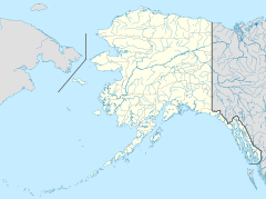
Paxson is found in the Copper River Census Area, Alaska. It sits at a special spot where two major roads, the Richardson Highway and the Denali Highway, come together. These roads pass through nearby mountain areas called Isabel Pass and Mentasta Pass.
The total area of Paxson is about 318 square miles (824 square kilometers). Most of this area is land, about 304 square miles (787 square kilometers). The rest, about 14 square miles (36 square kilometers), is water.
Understanding Paxson's Weather
Paxson experiences a very cold climate, typical of northern regions. It's called a continental subarctic climate. This means winters are long and very cold, while summers are short and cool.
Because of its high elevation, Paxson's climate is also close to an alpine climate. This means it's similar to the weather you'd find on a high mountain. Only one month of the year usually has an average temperature above 50 degrees Fahrenheit (10 degrees Celsius).
| Climate data for Paxson (1991–2020 normals, extremes 1914–2010) | |||||||||||||
|---|---|---|---|---|---|---|---|---|---|---|---|---|---|
| Month | Jan | Feb | Mar | Apr | May | Jun | Jul | Aug | Sep | Oct | Nov | Dec | Year |
| Record high °F (°C) | 41 (5) |
45 (7) |
52 (11) |
68 (20) |
77 (25) |
86 (30) |
86 (30) |
86 (30) |
79 (26) |
62 (17) |
48 (9) |
50 (10) |
86 (30) |
| Mean daily maximum °F (°C) | 9.5 (−12.5) |
18.1 (−7.7) |
22.5 (−5.3) |
38.1 (3.4) |
52.0 (11.1) |
64.3 (17.9) |
65.3 (18.5) |
59.7 (15.4) |
49.0 (9.4) |
33.0 (0.6) |
16.2 (−8.8) |
10.8 (−11.8) |
36.5 (2.5) |
| Daily mean °F (°C) | −0.1 (−17.8) |
7.4 (−13.7) |
10.7 (−11.8) |
26.4 (−3.1) |
40.7 (4.8) |
51.4 (10.8) |
53.8 (12.1) |
49.6 (9.8) |
39.9 (4.4) |
24.4 (−4.2) |
7.4 (−13.7) |
2.7 (−16.3) |
26.2 (−3.2) |
| Mean daily minimum °F (°C) | −9.7 (−23.2) |
−3.2 (−19.6) |
−1.1 (−18.4) |
14.8 (−9.6) |
29.3 (−1.5) |
38.5 (3.6) |
42.2 (5.7) |
39.5 (4.2) |
30.8 (−0.7) |
15.7 (−9.1) |
−1.4 (−18.6) |
−5.4 (−20.8) |
15.8 (−9.0) |
| Record low °F (°C) | −50 (−46) |
−46 (−43) |
−43 (−42) |
−50 (−46) |
−9 (−23) |
10 (−12) |
20 (−7) |
13 (−11) |
−5 (−21) |
−25 (−32) |
−39 (−39) |
−55 (−48) |
−55 (−48) |
| Average precipitation inches (mm) | 0.84 (21) |
0.56 (14) |
0.47 (12) |
0.47 (12) |
1.26 (32) |
2.29 (58) |
2.72 (69) |
3.12 (79) |
2.94 (75) |
1.66 (42) |
0.91 (23) |
1.07 (27) |
18.31 (465) |
| Average snowfall inches (cm) | 17.7 (45) |
21.0 (53) |
4.5 (11) |
17.0 (43) |
0.5 (1.3) |
0.0 (0.0) |
0.0 (0.0) |
0.0 (0.0) |
4.4 (11) |
15.4 (39) |
14.6 (37) |
16.4 (42) |
111.4 (283) |
| Average precipitation days | 5 | 4 | 5 | 5 | 6 | 11 | 11 | 13 | 11 | 7 | 5 | 7 | 90 |
| Source 1: NOAA (Precipitation 1981-2010) | |||||||||||||
| Source 2: WRCC | |||||||||||||
Population Changes in Paxson
| Historical population | |||
|---|---|---|---|
| Census | Pop. | %± | |
| 1980 | 30 | — | |
| 1990 | 30 | 0.0% | |
| 2000 | 43 | 43.3% | |
| 2010 | 40 | −7.0% | |
| 2020 | 26 | −35.0% | |
| U.S. Decennial Census | |||
Paxson first appeared on the U.S. Census in 1980 as a census-designated place. Its population has changed over the years. In 1980 and 1990, 30 people lived there. The population grew to 43 people in 2000.
By 2010, the population dropped slightly to 40. In the most recent count in 2020, only 26 people lived in Paxson. This shows it's a very small and quiet community. Most residents reported their race as white.
See also
 In Spanish: Paxson (Alaska) para niños
 | Aaron Henry |
 | T. R. M. Howard |
 | Jesse Jackson |


