Paz River facts for kids
Quick facts for kids Río Paz |
|
|---|---|
|
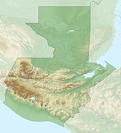
Location of mouth
|
|
| Countries | |
| Physical characteristics | |
| Main source | Quezalapa Mountains, Guatemala 1,700 m (5,600 ft) 14°22′06″N 90°02′13″W / 14.36833°N 90.03694°W |
| River mouth | Pacific Ocean 0 m (0 ft) 13°46′16″N 90°10′57″W / 13.77111°N 90.18250°W |
| Length | 134 km (83 mi) |
The Río Paz is an important river located in southern Guatemala. Its name, "Paz," means "peace" in Spanish. This river starts high up in the mountains and flows all the way to the Pacific Ocean.
It forms a natural border between two countries, Guatemala and El Salvador, for much of its journey.
Contents
Where Does the Río Paz Begin?
The Río Paz begins in the Quezalapa mountains. These mountains are found in the northern part of Jutiapa, a region in Guatemala. The river's starting point is quite high, about 1,700 meters (5,577 feet) above sea level.
How Long is the Río Paz?
The Río Paz is about 134 kilometers (83 miles) long. It flows generally towards the southwest. Along its path, it helps to mark the border between Guatemala and El Salvador.
Journey to the Ocean
As the river flows, it passes through different areas. In El Salvador, it goes through the Ahuachapán Department. It also flows into a place called Laguna el Espino. Finally, the Río Paz reaches the Pacific Ocean. At this point, the river is at sea level.
River Basin and Importance
The area of land that drains into the Río Paz is called its river basin. In Guatemala, this basin covers about 1,732 square kilometers (669 square miles). Rivers like the Río Paz are very important. They provide water for people, animals, and plants. They also help shape the land around them.
See also
 In Spanish: Río Paz para niños
 | Madam C. J. Walker |
 | Janet Emerson Bashen |
 | Annie Turnbo Malone |
 | Maggie L. Walker |


