Pecktonville, Maryland facts for kids
Quick facts for kids
Pecktonville, Maryland
|
|
|---|---|

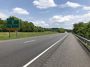
I-70's exit for US 40 in Pecktonville
|
|
| Country | United States |
| State | Maryland |
| County | Washington |
| Area | |
| • Total | 0.59 sq mi (1.52 km2) |
| • Land | 0.59 sq mi (1.52 km2) |
| • Water | 0.00 sq mi (0.00 km2) |
| Elevation | 463 ft (141 m) |
| Population
(2020)
|
|
| • Total | 164 |
| • Density | 278.44/sq mi (107.56/km2) |
| Time zone | UTC−5 (Eastern (EST)) |
| • Summer (DST) | UTC−4 (EDT) |
| ZIP code |
21711
|
| Area code(s) | 240 & 301 |
| GNIS feature ID | 2583670 |
Pecktonville is a small community found in Washington County, Maryland, in the United States. It is an "unincorporated community," which means it doesn't have its own city government. Instead, it is managed by the county. It is also a "census-designated place," meaning the U.S. Census Bureau has defined its borders just for counting people. In 2010, about 167 people lived there. By 2020, the population was 164.
Contents
Where is Pecktonville?
Pecktonville is located in the state of Maryland. It is part of Washington County. The community covers a small area of land.
Land Area
According to the U.S. Census Bureau, Pecktonville is about 0.59 square miles (1.52 square kilometers) in size. All of this area is land, with no water.
How Many People Live Here?
The number of people living in Pecktonville is counted during the United States Census, which happens every ten years.
Population Count
In 2010, the census recorded 167 people living in Pecktonville. By the time of the 2020 census, the population was 164. This shows it is a very small community.
More Information
If you want to learn more about Pecktonville in a different language, you can check out the Kiddle encyclopedia.
- In Spanish: Pecktonville para niños


