Pee Pee Island facts for kids
| Geography | |
|---|---|
| Location | Newfoundland and Labrador |
| Coordinates | 47°11′29″N 52°50′14″W / 47.19139°N 52.83722°W |
| Administration | |
|
Canada
|
|
| Additional information | |
| Time zone |
|
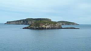
Pee Pee Island is a small island located in Newfoundland and Labrador, a province on the far east coast of Canada. It is one of four islands that make up the Witless Bay Ecological Reserve. This special reserve helps protect important wildlife.
About Pee Pee Island
Pee Pee Island is quite close to the mainland. It is only about 250 metres (820 feet) away. You can easily see the island from the village of Saint Michaels. It is also visible from the popular East Coast Trail.
Home to Puffins
Pee Pee Island became part of the Witless Bay Ecological Reserve in 1983. This was done to protect the island's wildlife. The island is a very important breeding ground for Atlantic Puffins. Each year, up to 1,300 pairs of these colorful birds come here to lay their eggs and raise their young.
A Bit of History
When the island joined the reserve, its name was changed. Before 1983, it was known as "Pebble Island." Soon after becoming a protected area, it was given its current name, Pee Pee Island.
Island Climate
The weather on Pee Pee Island changes throughout the year. February is usually the coldest month, with temperatures around -6 °C (21 °F). August is the warmest month, reaching about 14 °C (57 °F).
The island gets a lot of rain. The average rainfall each year is about 1,517 mm (60 inches). January is the wettest month, with about 185 mm (7.3 inches) of rain. July is the driest month, getting around 71 mm (2.8 inches) of precipitation.


