Peppercombe facts for kids
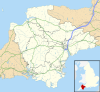
Peppercombe is a small, beautiful valley, also known as a combe, located on the north-western coast of Devon, England. It's a great spot for exploring nature! You can find it along the famous South West Coast Path, nestled between the towns of Westward Ho! to the north and Bucks Mills to the west. There's also a path that leads down to Peppercombe from Horns Cross, which is on the A39 road.
The valley is home to a small stream called Peppercombe Water. This stream is just over a kilometre long, but it has carved out a surprisingly deep valley. At the end of the stream, it tumbles down a series of small waterfalls. These waterfalls are between 0.5 and 1.5 metres tall. They formed because the rocks underneath have different hardness levels. The softer rocks wear away faster, creating the steps of the waterfall.
The part of Peppercombe closest to the sea is special. It's part of a protected area called the Hobby to Peppercombe biological Site of Special Scientific Interest (SSSI). This means it's important for its plants and animals. The coast just north-east of Peppercombe is also protected. It's part of the Mermaid's Pool to Rowden Gut geological SSSI, recognized for its interesting rocks and landforms.
Amazing Red Rocks of Peppercombe
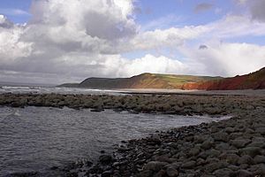
One of the coolest things about the sea cliffs between Peppercombe and Portledge to the north is their bright red color! Most of the rocks in the areas around Peppercombe are from a very old time called the Upper Carboniferous period. But the rocks right here in Peppercombe are different. They are a special patch, or outlier, of younger rocks. Scientists think these red rocks formed during the Permian period.
These red rocks stretch about 2 kilometres inland from the coast. They are mostly made of a type of rock called breccia. Breccia is a rock made from broken, angular pieces of other rocks cemented together. You can also find scattered bands and lumps of calcareous material, which means it contains calcium carbonate. Sometimes, there are also layers of sand and sandstone.
Scientists believe this patch of red rock is what's left of a much larger area of New Red Sandstone that once covered a big part of Devon. Over millions of years, most of it has been worn away by nature. The New Red Sandstone is much more common in south-eastern Devon. It's thought that these rocks formed from mud and sand washed down by heavy rainstorms. This happened in a dry desert area, next to rugged highlands, a very long time ago!
Peppercombe Castle: An Ancient Fort
Peppercombe Castle is an Iron Age Hill fort located right on the cliffs. It sits just west of the Peppercombe valley. An Iron Age hill fort was a fortified settlement built by people living in the Iron Age. They used natural high ground for protection.
It can be a bit tricky to see the remains of this fort on maps today. This is because a lot of the site might have been lost over time due to coastal erosion. Coastal erosion is when the sea slowly wears away the land. However, it seems the fort was built about 80 metres (around 260 feet) above sea level. Imagine building a fort there so long ago!
 | Ernest Everett Just |
 | Mary Jackson |
 | Emmett Chappelle |
 | Marie Maynard Daly |


