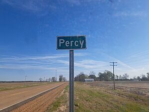
Percy, Mississippi facts for kids
Quick facts for kids
Percy, Mississippi
|
|
|---|---|
 |
|
| Country | United States |
| State | Mississippi |
| County | Washington |
| Elevation | 115 ft (35 m) |
| Time zone | UTC-6 (Central (CST)) |
| • Summer (DST) | UTC-5 (CDT) |
| ZIP code |
38748
|
| Area code(s) | 662 |
| GNIS feature ID | 692138 |
Percy is a small, unincorporated community located in Washington County, Mississippi. This means it's a place where people live, but it doesn't have its own local government like a city or town. Instead, it's governed by the county.
Percy is found about 3.3 miles (5.3 km) north of Panther Burn. It is also about 4.7 miles (7.6 km) south of Hollandale. You can find Percy right along U.S. Route 61, which is a major highway.
Contents
What is an Unincorporated Community?
An unincorporated community is a special kind of place. It's a group of homes and businesses that are not part of any official city or town. This means they don't have a mayor or a city council.
How Unincorporated Communities are Governed
Instead of having their own local government, unincorporated communities are managed by the larger county government. The county provides services like roads, police, and fire protection. This is different from a city, which has its own departments for these services.
Life in Percy, Mississippi
Percy is located in the state of Mississippi, in the southern United States. It's a quiet area, typical of many small communities in the region. The community is mainly surrounded by farmland, which is common in Washington County.
- Location: Percy is in Washington County, Mississippi.
- Nearby Towns: It is close to Panther Burn and Hollandale.
- Main Road: U.S. Route 61 runs right through the area.
Geography and Location
Percy is situated in the flat, fertile region known as the Mississippi Delta. This area is famous for its rich soil, which is great for farming. The land around Percy is mostly flat, making it easy to travel.
Elevation of Percy
The community of Percy is located at an elevation of about 115 feet (35 meters) above sea level. This low elevation is typical for areas within the Mississippi Delta. The Delta region is known for its flat landscape.
Finding Percy on a Map
You can find Percy using its geographic coordinates: 33°06′32″N 90°52′46″W. These numbers help pinpoint its exact spot on a map. The area uses the Central Time Zone (CST), which means it's 6 hours behind Coordinated Universal Time (UTC). During daylight saving time, it switches to CDT, which is 5 hours behind UTC.
Services and Codes
Even though Percy is an unincorporated community, it still has important services. These include mail delivery and phone services.
Postal and Area Codes
The ZIP code for Percy is 38748. This code helps the postal service deliver mail to homes and businesses in the area. The telephone area code for Percy is 662. This code is used for all phone numbers in this part of Mississippi.
 | James Van Der Zee |
 | Alma Thomas |
 | Ellis Wilson |
 | Margaret Taylor-Burroughs |


