Peveril Point facts for kids
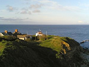
Peveril Point is a special piece of land that sticks out into the sea on the eastern coast of the Isle of Purbeck in Dorset, England. It's part of the town of Swanage and marks the southern end of Swanage Bay. You can find it at 50°36.43′N 01°56.69′W / 50.60717°N 1.94483°W.
How Peveril Point Formed
The rocks that make up Peveril Point are mostly a type of rock called shale, along with Portland and Purbeck limestone. These rocks are folded into a U-shape, which geologists call a syncline. This strong rock structure has been much tougher than the softer clay found in Swanage Bay. Over many, many years, the softer clay has worn away, but the harder limestone has stayed, forming the point we see today.
Keeping Watch at Peveril Point
Peveril Point is an important place for keeping an eye on the sea.
- A National Coastwatch Institution lookout station is located here. Volunteers at this station watch the sea to help keep people safe. They report anything unusual or dangerous to the Coastguard.
- The Swanage lifeboat organisation also calls Peveril Point home. The lifeboat crew are volunteers who are ready to launch their boat and rescue people in trouble at sea, no matter the weather.
A Look Back: Peveril Point in World War II
During World War II, Peveril Point played a role in defending England. Tunnels were built here, connecting old gun positions. These guns were placed to protect the entrance to Southampton Water, which is a very important shipping area. Even though the guns are no longer there, the tunnels remain as a reminder of the point's history during the war.
 | Sharif Bey |
 | Hale Woodruff |
 | Richmond Barthé |
 | Purvis Young |


