Pickwick Island facts for kids

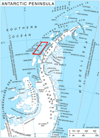
Location of Biscoe Islands in the Antarctic Peninsula region
|
|
|
Location in Antarctica
|
|
| Geography | |
|---|---|
| Location | Antarctica |
| Coordinates | 65°29′S 65°38′W / 65.483°S 65.633°W |
| Administration | |
| Administered under the Antarctic Treaty System | |
| Demographics | |
| Population | Uninhabited |
Pickwick Island is the biggest island in the Pitt Islands. These islands are part of the larger Biscoe Islands group, located off the coast of Antarctica. It's a remote and icy place, just like much of the Antarctic continent. The island is not home to any people.
About Pickwick Island
Pickwick Island stretches about 9.45 kilometers (almost 6 miles) from its southwest to its northeast end. It is separated from Renaud Island to its southwest by a narrow waterway called Mraka Sound. On its northeast side, the coast curves inward, forming a bay known as Misionis Bay.
Discovery and Naming
Explorers first roughly mapped Pickwick Island between 1934 and 1937. This mapping was done by the British Graham Land Expedition (BGLE), led by a famous explorer named John Rymill. Later, in 1957, the Argentine government created a more accurate map of the island.
The island received its name in 1959 from the United Kingdom Antarctic Place-Names Committee (UK-APC). They decided to name it after Samuel Pickwick. He is a well-known character from a famous book called Pickwick Papers, written by the British author Charles Dickens. Samuel Pickwick is the founder of a fictional group called the Pickwick Club in the story.


