Pim Island facts for kids

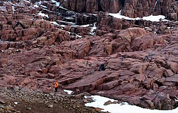
2005 photo of Pim Island
|
|
| Geography | |
|---|---|
| Location | Northern Canada |
| Coordinates | 78°44′N 074°25′W / 78.733°N 74.417°W |
| Archipelago | Queen Elizabeth Islands Canadian Arctic Archipelago |
| Administration | |
|
Canada
|
|
| Territory | Nunavut |
| Region | Qikiqtaaluk |
| Demographics | |
| Population | Uninhabited |
Pim Island, sometimes called Bedford Pim Island, is a small island in northern Canada. It is located just off the eastern coast of Ellesmere Island. This area is part of the Qikiqtaaluk Region in Nunavut, a large territory in Canada.
Pim Island is also part of the Canadian Arctic Archipelago, which is a group of many islands in the Arctic Ocean. It belongs to the Queen Elizabeth Islands, a northern part of this archipelago.
Where is Pim Island?
Pim Island is separated from Ellesmere Island by a waterway called Rice Strait. This strait connects Rosse Bay to the south with Buchanan Bay to the north. To the east of Pim Island is Nares Strait. The island is about 6 kilometers (or 3.7 miles) away from Cocked Hat Island.
Pim Island's History
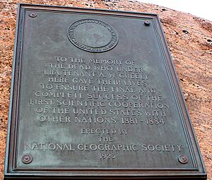
Pim Island has a connection to early Arctic exploration. In 1883, an expedition led by Adolphus Greely spent the winter at a place called Camp Clay on the island. The next year, in 1884, Cape Sabine on Pim Island became a rescue site for Greely and his team, known as the Lady Franklin Bay Expedition.
The island was named to honor Bedford Pim. He was a naval officer and lawyer who served on a ship called HMS Resolute.
 | Leon Lynch |
 | Milton P. Webster |
 | Ferdinand Smith |


