
Ponce Historic Zone facts for kids
The
Quick facts for kids
Ponce Historic Zone
Zona Histórica de Ponce
|
|
|---|---|
|
Historic Zone
|
|

Parque de Bombas, the iconic symbol of the Historic Zone
|
|
| Nickname(s):
La Perla del Sur
|
|
| Motto(s):
Ponce es Ponce
|
|

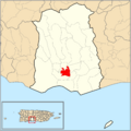
Map of the Historic Zone within the municipality of Ponce
|
The Ponce Historic Zone (also called La Zona Histórica de Ponce) is a special area in downtown Ponce, Puerto Rico. It's full of old buildings and structures. These buildings show off the amazing architecture from the late 1800s and early 1900s. People also call it Ponce Tradicional, Ponce Centro, Ponce Histórico, or Distrito Histórico.
Contents
History of the Historic Zone

The idea for the Ponce Historic Zone started a long time ago. In 1893, the Governor of Puerto Rico, Antonio Daban y Ramirez de Arellano, made a rule. This rule said that towns had to divide their centers into three areas for fire safety.
Buildings had to be made of stone, fire-resistant materials, or other materials. Near the main town square, buildings had to be made of stone. This rule helped set the stage for what would become the Historic Zone many years later.
Official Creation of the Zone
On June 20, 1960, Governor Luis Muñoz Marín changed a law. This change made it possible for Ponce to have its own historic zone. Then, on June 6, 1962, the zone was officially created.
At first, it only included the very center of the city. Later, it grew to cover a much larger area. The Instituto de Cultura Puertorriqueña (Institute of Puerto Rican Culture) approved this new zone. It listed 22 areas, including buildings, plazas, streets, and neighborhoods, that needed to be protected.
Challenges and Support
After the Historic Zone was created, some local developers and real estate businesses were not happy. They felt it limited what they could build or change. Ismaro Torruella, a local leader, first supported the zone but later wanted to limit or remove it.
Groups formed to discuss the issue. One group, the "Citizens Committee for Ponce's Progress," included important business people. To balance this, supporters of the zone formed the "Ponce Citizens' Committee for Fair Progress." Many public meetings were held over several years.
Studies were done on the architecture in the zone. They found seven main styles, like Neoclassical European and Spanish Colonial.
In 2005, the Governor of Puerto Rico, Aníbal Acevedo Vilá, officially recognized the historic center of Ponce as a "Historic Center of First Order."
Exploring the Historic Zone
The Ponce Historic Zone is located in what people call Ponce Pueblo. This is the oldest and central part of the city. You can get there by different roads. A common way is using PR-1, which leads to Plaza Las Delicias.
Famous Landmarks and Architecture
.jpg)
In the heart of the zone is Plaza Las Delicias. Here you'll find the unique Parque de Bombas (old firehouse) and the beautiful Nuestra Señora de la Guadalupe Cathedral.
Other important places in the zone include:
- Ponce City Hall
- Armstrong-Poventud Residence
- Ponce High School
- Panteón Nacional Román Baldorioty de Castro
Many buildings in this area are listed on the National Register of Historic Places. These include Banco de Ponce, Casa Paoli, and Casa de la Masacre. Other places, like Teatro Fox Delicias, Teatro La Perla, Plaza de Mercado, and Hotel Meliá, are also very important to the city's history.
You'll notice that many street corners in this zone have chamfered corners. This means they are cut diagonally, a style often seen in Barcelona, Spain.
Plan Ponce en Marcha (Ponce on the Move Plan)

In the 1990s, a huge project called "Plan Ponce en Marcha" (Ponce on the Move Plan) began. It cost $440 million and aimed to make the city's historic area even better. The project increased the number of historic buildings from 260 to 1,046.
This plan was started in 1985 by then-Governor Rafael Hernández Colón. Many buildings in Ponce are now listed on the National Register of Historic Places. The Project for Public Places even called downtown Ponce one of the "60 of the World's Great Places." They praised it for being a "graciously preserved showcase of Caribbean culture."
The Ponce en Marcha project has helped define and develop the Ponce Historic Zone. It involved many government departments working together to improve the city. For example, they worked on housing projects, road construction, and burying power lines to preserve the historic look.
Categories of Historic Structures
Buildings within the historic zone are placed into four different groups:
- Category 1: These are buildings with great historical importance. They are a key part of the city's heritage.
- Category 2: These buildings might not be as grand, but they still have important historical, architectural, or cultural features.
- Category 3: These structures have "contextual value." This means they might not be super special on their own. But they make the area look better when seen as part of a larger group of buildings or a street's overall style.
- Category 4: This group includes buildings in the historic zone that haven't been studied yet. Their value is still unknown.
Different Areas of the Historic Zone

The historic zone itself is divided into three smaller areas:
- First Order Zone: This is the original historic zone, created in 1962. It's the area right around Plaza Las Delicias.
- Second Order Zone: This area was added in 1989. It made the historic zone bigger, extending further out from Plaza Las Delicias.
- Third Order Zone: This zone was added in 1992. It included neighborhoods like Mariani, Belgica, and parts of Clausells and Cantera. It also expanded east of Rio Portugues to include La Alhambra.
In 2003, Mayor Cordero suggested removing some of the poorer neighborhoods, like Belgica, Claussells, and Cantera, from the historic zone.
Images for kids
-
Map of the Historic Zone within the municipality of Ponce
See also
 In Spanish: Zona Histórica de Ponce para niños
