Pond of Drummond facts for kids
Quick facts for kids Pond of Drummond |
|
|---|---|
| Location | NN85541858 |
| Coordinates | 56°20′46″N 3°51′14″W / 56.346°N 3.854°W |
| Type | freshwater reservoir |
| Primary outflows | River Earn |
| Max. length | 1.0621 km (0.6600 mi) |
| Max. width | 0.5310835 km (0.3300000 mi) |
| Surface area | 34 ha (84 acres) |
| Average depth | 5 ft (1.5 m) |
| Max. depth | 12 ft (3.7 m) |
| Water volume | 20,157,000 cu ft (570,800 m3) |
| Shore length1 | 3 km (1.9 mi) |
| Surface elevation | 47 m (154 ft) |
| Islands | 0 |
| 1 Shore length is not a well-defined measure. | |
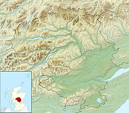
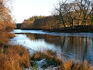
The Pond of Drummond is a small, man-made freshwater loch (that's a Scottish word for lake!). It's located on the beautiful grounds of Drummond Castle in Perth and Kinross, Scotland. This pond stretches from east to west and is about 2 miles southeast of a town called Crieff. It's a shallow body of water, but it holds a fascinating secret beneath its surface!
Contents
The Mystery of the Sunken Village
If you look at aerial pictures of the Pond of Drummond, you might notice something strange. You can clearly see the faint outlines of a village that used to be there! This area, now covered by water, was once a valley where people lived and farmed.
How the Village Disappeared
The land where the village stood was taken over by the government after a big historical event in 1745. It was then given to people who had supported the government at that time.
Later, between 1785 and 1800, a lady named Lady Jean (also known as Lady Perth) decided to turn this small valley into the loch we see today. So, the village slowly disappeared under the water!
What You Can Still See
Maps of the loch show that the village had a main street running from east to west. Houses were built on both sides of this street. Each house had its own 1-acre plot of land behind it, set at a right angle to the house.
The village was known to stretch east towards an old military road. Today, if you look closely at the water, you can still see parts of the main road and some of the old plot boundaries. However, the western end of the loch is deeper, so it's harder to see anything there.
The Pond's Outflow
A small river flows out of the Pond of Drummond to the east. This river then feeds into another long, shallow pond called BennyBeg Pond. BennyBeg Pond also runs from east to west. It's possible that the old village even extended as far as the boundaries of BennyBeg Pond, which is about half a mile to the east.


