Portland, Iowa facts for kids
Quick facts for kids
Portland, Iowa
|
|
|---|---|
| Country | United States |
| State | Iowa |
| County | Cerro Gordo |
| Area | |
| • Total | 1.01 sq mi (2.61 km2) |
| • Land | 0.99 sq mi (2.57 km2) |
| • Water | 0.02 sq mi (0.04 km2) |
| Elevation | 1,078 ft (329 m) |
| Population
(2020)
|
|
| • Total | 28 |
| • Density | 28.23/sq mi (10.90/km2) |
| Time zone | UTC-6 (Central (CST)) |
| • Summer (DST) | UTC-5 (CDT) |
| ZIP code |
50401
|
| FIPS code | 19-64155 |
| GNIS feature ID | 0460368 |
Portland is a small community in Iowa, United States. It is not an official city or town. Instead, it is called an unincorporated community. It is also a census-designated place (CDP). This means the government counts the people living there for official records.
Portland is located in Cerro Gordo County. In 2010, 35 people lived there. By 2020, the population was 28 people.
History of Portland
Portland has always been a small place. In 1925, only 17 people lived in the community. By 1940, the population grew to 50 people. Since then, the number of residents has changed a bit.
Where is Portland Located?
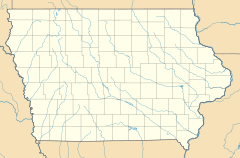
Portland is in the northern part of Iowa. It is in the eastern part of Cerro Gordo County. The community sits on the northeast bank of the Winnebago River.
The city of Mason City is very close to Portland. Mason City's limits are just north of Portland. Downtown Mason City is about 6 miles (10 km) to the northwest. A major road, U.S. Route 18, is about 1 mile (1.6 km) south of Portland.
Population Information
The United States government counts how many people live in different places. This is called a census.
| Historical population | |||
|---|---|---|---|
| Census | Pop. | %± | |
| 2020 | 28 | — | |
| U.S. Decennial Census | |||
In 2020, the census showed that 28 people lived in Portland. This number helps us understand how communities grow or shrink over time.
See also
 In Spanish: Portland (Iowa) para niños
 | James Van Der Zee |
 | Alma Thomas |
 | Ellis Wilson |
 | Margaret Taylor-Burroughs |


