Possession Island (Queensland) facts for kids
| Geography | |
|---|---|
| Location | Northern Australia |
| Coordinates | 10°43′36″S 142°23′49″E / 10.72667°S 142.39694°E |
| Area | 5.5 km2 (2.1 sq mi) |
| Administration | |
| State | Queensland |
| Shire | Shire of Torres |
Possession Island is a small island located near the very top of Queensland, Australia. It's part of the Torres Strait Islands, a group of islands in the sea between Australia and Papua New Guinea. The island is known by its traditional names, Bedanug or Bedhan Lag, in the Kalaw Lagaw Ya language. Today, some Torres Strait Islander people, especially the Kaurareg group, live on the island. The Ankamuti people also originally lived here.
Contents
About Possession Island National Park
Possession Island is part of the Possession Island National Park. This park covers about 5.10 square kilometers (about 2 square miles). It also includes a nearby island called Eborac Island. The park was created in 1977 to protect the island's nature and history. The Queensland Parks and Wildlife Service looks after it.
History of Possession Island
Captain Cook's Visit in 1770
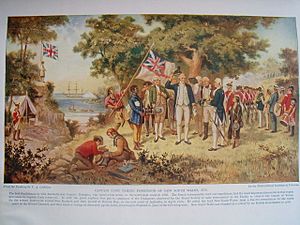
In 1770, a British explorer named Lieutenant James Cook sailed along the east coast of Australia. His ship was called the Endeavour. After exploring for several months, he reached Possession Island.
On August 22, 1770, Cook landed on the island. He raised the British flag, called the Union Flag. He then claimed the entire eastern coast of Australia for Britain. He named this vast area "New South Wales." This event was a very important moment in Australia's history.
Native Title Rights
For thousands of years before Cook arrived, Indigenous people lived on Possession Island. These were the traditional owners of the land. In 2001, the Kaurareg people successfully claimed their native title rights over the island. This means their traditional ownership and connection to the land were officially recognized by Australian law.


