Pottersville, Indiana facts for kids
Quick facts for kids
Pottersville, Indiana
|
|
|---|---|
 |
|
| Country | United States |
| State | Indiana |
| County | Owen |
| Township | Franklin |
| Elevation | 636 ft (194 m) |
| Time zone | UTC-5 (Eastern (EST)) |
| • Summer (DST) | UTC-4 (EDT) |
| ZIP code |
47431
|
| Area code(s) | 812, 930 |
| GNIS feature ID | 441507 |
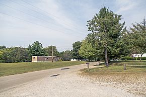
Pottersville is a small place in Owen County, Indiana, in the United States. It is called an unincorporated community. This means it is a group of homes and businesses that is not officially a town or city with its own local government. Pottersville is part of Franklin Township.
History of Pottersville
Pottersville was officially planned and created in the year 1858. When a place is "laid out," it means its streets and lots were designed on a map. This happened before people started building homes and businesses there.
Where is Pottersville?
Pottersville is located in a specific spot on Earth. We can describe its exact location using special numbers called coordinates. These numbers are like an address for any place on a map. Pottersville is at 39°12′26″N 86°48′51″W / 39.20722°N 86.81417°W. This means it is 39 degrees, 12 minutes, and 26 seconds North of the equator. It is also 86 degrees, 48 minutes, and 51 seconds West of the Prime Meridian.
The land where Pottersville sits is about 194 meters (or 636 feet) above sea level.


