
Presidencia Roque Sáenz Peña facts for kids
Quick facts for kids
Presidencia Roque Sáenz Peña
|
||
|---|---|---|
|
||

Presidencia Roque Sáenz Peña
Location in Chaco Province
|
||
| Country | ||
| Province | ||
| Department | Comandante Fernández | |
| Population
(2010 census)
|
||
| • Total | 89,882 | |
| Time zone | UTC-3 (ART) | |
| CPA base |
H3700
|
|
| Dialing code | +54 3732 | |
| Climate | Cfa | |

Presidencia Roque Sáenz Peña is a city in the Chaco Province of Argentina. People often call it simply Sáenz Peña. It is the second largest city in the province.
The city is about 170 kilometers (106 miles) west-northwest of Resistencia. Resistencia is the capital city of the Chaco Province. Sáenz Peña is on a main road and rail route that crosses northern Argentina. This route goes towards Salta.
In 2001, the city's main area had about 76,377 people. The whole area around the city had about 88,164 people. Sáenz Peña was started in 1912. It has grown into an important center for business and industry. It helps the farms in the Gran Chaco plains.
Climate in Sáenz Peña
The climate in Presidencia Roque Sáenz Peña is called a humid subtropical climate. This means it has hot, wet summers and mild winters.
| Climate data for Presidencia Roque Sáenz Peña, Chaco | |||||||||||||
|---|---|---|---|---|---|---|---|---|---|---|---|---|---|
| Month | Jan | Feb | Mar | Apr | May | Jun | Jul | Aug | Sep | Oct | Nov | Dec | Year |
| Record high °C (°F) | 44.5 (112.1) |
42.9 (109.2) |
41.9 (107.4) |
38.8 (101.8) |
39.0 (102.2) |
35.2 (95.4) |
36.7 (98.1) |
40.4 (104.7) |
43.0 (109.4) |
46.2 (115.2) |
44.5 (112.1) |
44.2 (111.6) |
46.2 (115.2) |
| Mean daily maximum °C (°F) | 34.0 (93.2) |
32.4 (90.3) |
31.1 (88.0) |
27.2 (81.0) |
24.4 (75.9) |
21.9 (71.4) |
22.5 (72.5) |
24.8 (76.6) |
26.8 (80.2) |
29.4 (84.9) |
31.1 (88.0) |
33.0 (91.4) |
28.2 (82.8) |
| Daily mean °C (°F) | 27.1 (80.8) |
26.1 (79.0) |
24.6 (76.3) |
20.8 (69.4) |
17.9 (64.2) |
15.6 (60.1) |
15.3 (59.5) |
17.0 (62.6) |
19.2 (66.6) |
22.3 (72.1) |
24.2 (75.6) |
26.2 (79.2) |
21.4 (70.5) |
| Mean daily minimum °C (°F) | 20.2 (68.4) |
19.4 (66.9) |
18.4 (65.1) |
14.9 (58.8) |
12.2 (54.0) |
10.0 (50.0) |
8.8 (47.8) |
9.8 (49.6) |
11.8 (53.2) |
15.1 (59.2) |
17.0 (62.6) |
19.2 (66.6) |
14.7 (58.5) |
| Record low °C (°F) | 8.4 (47.1) |
6.8 (44.2) |
3.9 (39.0) |
0.7 (33.3) |
−5.5 (22.1) |
−7.3 (18.9) |
−7.4 (18.7) |
−8.7 (16.3) |
−6.5 (20.3) |
0.2 (32.4) |
2.6 (36.7) |
5.0 (41.0) |
−8.7 (16.3) |
| Average precipitation mm (inches) | 136.7 (5.38) |
120.0 (4.72) |
130.7 (5.15) |
113.6 (4.47) |
47.4 (1.87) |
25.4 (1.00) |
18.6 (0.73) |
21.7 (0.85) |
37.4 (1.47) |
90.9 (3.58) |
118.9 (4.68) |
125.3 (4.93) |
986.6 (38.84) |
| Average precipitation days | 7 | 7 | 7 | 7 | 6 | 5 | 3 | 3 | 4 | 7 | 7 | 7 | 70 |
| Average relative humidity (%) | 70 | 72 | 76 | 78 | 78 | 78 | 73 | 67 | 64 | 67 | 69 | 69 | 72 |
| Mean monthly sunshine hours | 285.2 | 243.0 | 229.4 | 189.0 | 189.1 | 150.0 | 186.0 | 204.6 | 207.0 | 241.8 | 264.0 | 285.2 | 2,674.3 |
| Percent possible sunshine | 67 | 66 | 60 | 55 | 56 | 46 | 57 | 58 | 58 | 61 | 65 | 67 | 60 |
| Source: Instituto Nacional de Tecnología Agropecuaria (temperature 1930–2013, precipitation 1924–2013, humidity 1965–2013 and sun 1968–2013) | |||||||||||||
Getting Around
The city has its own airport. It is called Primer Teniente Jorge Eduardo Casco Airport. This airport helps people travel to and from Sáenz Peña.
Images for kids
-
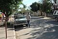
A residential area in Sáenz Peña.
-
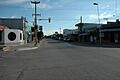
A busy commercial street in the city.


See also
 In Spanish: Presidencia Roque Sáenz Peña para niños
