Primehook Creek (Broadkill River tributary) facts for kids
Quick facts for kids Primehook Creek |
|
|---|---|
|
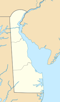
Location of Primehook Creek mouth
|
|
| Other name(s) | Tributary to Broadkill River |
| Country | United States |
| State | Delaware |
| County | Sussex |
| Physical characteristics | |
| Main source | confluence of North Prong, Sowbridge Branch, and Ingram Branch Waples Pond 4 ft (1.2 m) 38°49′32″N 075°18′22″W / 38.82556°N 75.30611°W |
| River mouth | Broadkill River Broadkill Beach, Delaware 0 ft (0 m) 38°50′04″N 075°13′20″W / 38.83444°N 75.22222°W |
| Length | 7.85 mi (12.63 km) |
| Basin features | |
| Progression | generally east |
| River system | Broadkill River |
| Basin size | 28.16 square miles (72.9 km2) |
| Tributaries |
|
| Bridges | none |
Primehook Creek is a small stream, about 7.85 mi (12.63 km) long, located in Sussex County, Delaware. It flows into the Broadkill River. Think of it as a smaller stream that feeds into a larger river.
This creek has also been known by a couple of other names in the past. People sometimes called it Prime Hook Creek or Prune Hook Creek.
Where Does Primehook Creek Start and End?
Primehook Creek begins in a place called Waples Pond. It forms where three smaller streams, North Prong, Sowbridge Branch, and Ingram Branch, all join together.
From there, Primehook Creek generally flows towards the east. Its journey ends when it meets the Broadkill River near Broadkill Beach, Delaware.
Understanding the Primehook Creek Area
The land area that drains water into Primehook Creek is quite large. It covers about 28.16 square miles (72.9 km2). This area is called its watershed.
The region around Primehook Creek gets a good amount of rain each year, around 45.3 inches. A small part of this area, about 13%, is covered by forests.
There used to be a big swamp here, filled with Red Maple and Alder trees. However, due to saltwater coming in from the ocean, many of these trees might not be alive anymore. This shows how changes in the environment can affect natural areas.
 | Chris Smalls |
 | Fred Hampton |
 | Ralph Abernathy |


