Puerto López, Meta facts for kids
Quick facts for kids
Puerto López, Meta
|
|||
|---|---|---|---|
|
Municipality and town
|
|||
 |
|||
|
|||

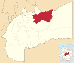
Location of the municipality and town of Puerto López, Meta in the Meta Department of Colombia.
|
|||
| Country | |||
| Department | Meta Department | ||
| Founded | May 1, 1935 | ||
| Area | |||
| • Total | 6,740 km2 (2,602.33 sq mi) | ||
| Elevation | 365 m (1,198 ft) | ||
| Population
(2015)
|
|||
| • Total | 33,440 | ||
| Time zone | UTC-5 (Colombia Standard Time) | ||
| Climate | Am | ||
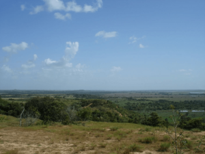
Puerto López, also known as Puerto Alfonso López, is a town and municipality in the Meta Department of Colombia. It is located in the Orinoquía Region, which is also called the Llanos region. This area is famous for its wide, flat grasslands.
The town is an important port on the Meta River. It is about 100 kilometers (62 miles) east of the city of Villavicencio. The main ways people make a living here are through farming and raising cattle.
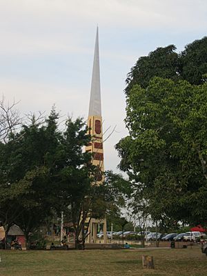
Puerto López is often called the "belly button" or geographical center of Colombia. Near the town, you can find the Obelisco del Alto de Menegua. This is a tall monument, about 30 meters (98 feet) high. It marks a special spot where 4 degrees north latitude and 72 degrees west longitude meet.
History of Puerto López
Puerto López was officially started on May 1, 1935. It grew around an existing village and its river port.
On May 3, 1937, the Meta Department decided to create a new district called Yacuana. Puerto Alfonso López was chosen as its main town. Later, on July 3, 1955, Puerto López became a full municipality. This change was made according to a national rule from 1945.
Climate in Puerto López
Puerto López has a tropical monsoon climate. This means it has warm temperatures all year round. It also experiences a wet season with lots of rain and a drier season.
The weather information below shows the average temperatures and rainfall for the area.
| Climate data for Puerto López (Margaritas Las Hda), elevation 150 m (490 ft), (1981–2010) | |||||||||||||
|---|---|---|---|---|---|---|---|---|---|---|---|---|---|
| Month | Jan | Feb | Mar | Apr | May | Jun | Jul | Aug | Sep | Oct | Nov | Dec | Year |
| Mean daily maximum °C (°F) | 34.3 (93.7) |
34.8 (94.6) |
34.4 (93.9) |
32.5 (90.5) |
31.2 (88.2) |
30.1 (86.2) |
30.2 (86.4) |
30.8 (87.4) |
31.8 (89.2) |
32.0 (89.6) |
32.1 (89.8) |
32.8 (91.0) |
32.2 (90.0) |
| Daily mean °C (°F) | 27.8 (82.0) |
28.0 (82.4) |
27.9 (82.2) |
26.9 (80.4) |
26.3 (79.3) |
25.5 (77.9) |
25.4 (77.7) |
25.7 (78.3) |
26.3 (79.3) |
26.5 (79.7) |
26.6 (79.9) |
26.9 (80.4) |
26.6 (79.9) |
| Mean daily minimum °C (°F) | 21.7 (71.1) |
22.1 (71.8) |
22.2 (72.0) |
22.6 (72.7) |
22.2 (72.0) |
22.0 (71.6) |
21.8 (71.2) |
22.0 (71.6) |
22.2 (72.0) |
22.4 (72.3) |
22.5 (72.5) |
21.9 (71.4) |
22.1 (71.8) |
| Average precipitation mm (inches) | 13.8 (0.54) |
37.9 (1.49) |
92.4 (3.64) |
230.8 (9.09) |
313.9 (12.36) |
330.4 (13.01) |
291.9 (11.49) |
257.2 (10.13) |
230.2 (9.06) |
232.7 (9.16) |
140.7 (5.54) |
25.6 (1.01) |
2,197.7 (86.52) |
| Average precipitation days | 2 | 4 | 8 | 14 | 19 | 20 | 18 | 17 | 14 | 13 | 10 | 3 | 136 |
| Average relative humidity (%) | 72 | 71 | 72 | 78 | 82 | 85 | 86 | 85 | 83 | 82 | 82 | 78 | 80 |
| Mean monthly sunshine hours | 226.3 | 200.4 | 164.3 | 132.0 | 130.2 | 138.0 | 133.3 | 142.6 | 165.0 | 176.7 | 177.0 | 213.9 | 1,999.7 |
| Mean daily sunshine hours | 7.3 | 7.1 | 5.3 | 4.4 | 4.2 | 4.6 | 4.3 | 4.6 | 5.5 | 5.7 | 5.9 | 6.9 | 5.5 |
| Source: Instituto de Hidrologia Meteorologia y Estudios Ambientales | |||||||||||||
See also
 In Spanish: Puerto López (Colombia) para niños
 | Jessica Watkins |
 | Robert Henry Lawrence Jr. |
 | Mae Jemison |
 | Sian Proctor |
 | Guion Bluford |


