Meta River facts for kids
Quick facts for kids Meta River |
|
|---|---|

|
|

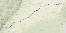
Course of the Río Meta.
|
|
| Country | Colombia Venezuela |
| Physical characteristics | |
| Main source | Colombia c. 1,300 m (4,300 ft) |
| River mouth | Orinoco at Puerto Carreño 6°11′43″N 67°27′23″W / 6.19517°N 67.4564°W |
| Length | 1,100 km (680 mi) |
| Basin features | |
| Basin size | 103,000 km2 (40,000 sq mi) to 106,733 km2 (41,210 sq mi) |
The Meta River is a very important river in South America. It flows through eastern Colombia and southern Venezuela. This river is a major branch of the huge Orinoco River.
The Meta River starts high up in the Andes mountains in Colombia. It forms where smaller rivers like the Humea, Guatiquía, and Guayuriba join together. From there, it flows east across wide, flat plains known as the Llanos Orientales. The river follows a natural crack in the Earth called the Meta Fault.
The Meta River forms part of the northern border of Colombia's Vichada Department. It flows along the border with other Colombian departments and then with Venezuela. Finally, it joins the Orinoco River at Puerto Carreño.
The Meta River is about 1,100 kilometers (680 miles) long. Its drainage basin, which is the area of land that drains into the river, covers about 103,000 square kilometers (40,000 square miles).
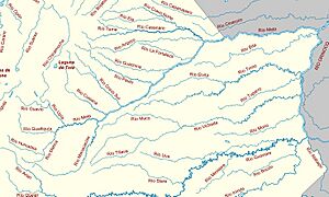
The river actually divides the Colombian Llanos into two different parts. The western side, on the left bank, gets more rain. It also receives rich soil from the Andes mountains. This makes the soil and smaller rivers in this area full of nutrients. The eastern side, however, has a longer dry season. Its soil and water have fewer nutrients.
Some of the main rivers that flow into the Meta River are the Cravo Sur, the Casanare, the Cusiana, the Upía, and the Manacacías rivers.
Contents
History of the Meta River
Early Explorers
In 1531, a European explorer named Diego de Ordáz was exploring the Orinoco River. He became the first European to find where the Meta River flows into the Orinoco. People told him there was gold near the Meta River's source. So, he and his group sailed upstream for 50 days. But the water level was too low, and they had to turn back.
Later, in 1536, another group of Europeans reached the very beginning of the Meta River. This expedition was led by a person named Georg Hohermuth von Speyer.
Life on the River in the Past
An old painting from 1856 shows what life was like on the Meta River. The painting was made by Manuel María Paz. It shows three local people with a boat near a place called Orocué. This gives us a peek into the past of the river.
People of the Meta River
Many different groups of indigenous people live along the Meta River. Indigenous means they are the original people of that land.
Indigenous Groups Living Along the River
In the upper parts of the river, near the mountains, and further downstream, you can find several groups. These include the Guayupe, Achagua, Sáliva, and Guahibo people. These groups have lived by the river for a very long time.
How the Meta River Helps People
The Meta River is very important for trade and travel in the region.
River Trade and Transport
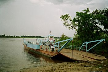
Starting from a town called Puerto López, boats can travel on the Meta River. This makes the river a key way to move goods and people across the plains of Colombia and Venezuela. It helps connect communities and businesses in the Llanos.
See also
 In Spanish: Río Meta para niños
 | Jewel Prestage |
 | Ella Baker |
 | Fannie Lou Hamer |


