
San Fernando de Apure facts for kids
Quick facts for kids
San Fernando de Apure
|
||
|---|---|---|
_y_Puerto_Miranda_(Gu%C3%A1rico)_y_el_R%C3%ADo_Apure._Venezuela..jpg)
Aerial view of San Fernando, Puerto Miranda and the Apure river
|
||
|
||
| Nickname(s):
"Ciudad de la Esperanza"
(English:"City of Hope") |
||
| Motto(s):
None
|
||

San Fernando de Apure
Location in Apure
.svg)
San Fernando de Apure
Location in Venezuela
|
||
| Country | ||
| State | Apure | |
| Counties | San Fernando | |
| Area | ||
| • Total | 5,982 km2 (2,310 sq mi) | |
| Elevation | 47 m (154 ft) | |
| Population
(2011 census)
|
||
| • Total | 165,135 | |
| • Density | 27.6053/km2 (71.497/sq mi) | |
| Time zone | UTC−4 (VET) | |
| Climate | Aw | |
| Website | Alcaldía de San Fernando | |

San Fernando de Apure is a city in Apure State, Venezuela. In 2011, about 165,135 people lived in its municipality area. Long ago, in the 1700s, the city was known for exporting heron feathers, which were used for pens, and animal hides.
A famous bridge called "Maria Nieves" crosses the Apure River in San Fernando. Its construction started in 1959 and it opened on February 1, 1961. It cost 8.5 million bolivars to build.
Another important place is the Casa de Bolivar. It is a National Historical Monument. This building was once an armory in the 1700s and the home of General Miguel Gerrero. Today, it has a public library and offices for cultural activities. It was restored in 1983.
Contents
History of San Fernando de Apure
San Fernando was founded on February 28, 1788. A military leader named Fernando Miyares y González ordered its creation. Lieutenant Major Juan Antonio Rodríguez and Fray Buenaventura de Benaocaz carried out the founding. They named it "Villa de San Fernando del Paso Real de Apure."
About 200 local people watched the founding ceremony. Lieutenant Juan Antonio Rodriguez checked the land. He said it had good air, plenty of land for farming and raising animals, wood, and fresh water. They marked the main square, now called Plaza Bolívar. A cross was placed where the church would be built. The Lieutenant then declared, "The Villa Real de San Fernando is hereby founded!" Later, in December 1783, it officially became a "Villa" because of its important location.
Famous explorer Alexander von Humboldt visited San Fernando between March 27 and 30, 1800. Five years later, in 1815, Fray Joaquín María drew the second map of the town. He also wrote down its borders and areas.
Schools began to appear in San Fernando in the 1830s. In 1831, Juan Castellanos opened the first private school for young children. Later, the Second Category Federal School was created in 1875. The Leon XIII Federal School also opened at the end of that century.
City records show a big fire on June 21, 1859, during the Federal War. The Federal Army set fire to much of the city, almost destroying it.
By 1908, San Fernando's streets ran north to south. The main streets are now called Calle Comercio, Calle Bolívar, Calle Sucre, Calle Páez, and Calle Muñoz. At that time, San Fernando was a busy port on the Apure River. The main port area was about 400 meters long. Today, much of the old port is dry land with buildings.
In the early 1900s, San Fernando had a lot of business and factories. They made food like pasta and canned goods. There were also factories for candles, ice, and places that sold heron feathers and animal skins. The city traded a lot with Europe. This trade slowed down when people stopped needing as many exports. Also, land travel became more popular than river travel. This was because of new railroads and early cars like the Ford Model T, which were great for carrying goods.
The first automobile arrived in San Fernando in 1914. It was a Ford Model T.
More schools opened for older students. The Miranda School started in 1931 and later became the Lazo Martí School. The Sagrada Familia school opened in 1953. In 1964, the Juan Lovera School of Plastic Arts began teaching art.
In 1916, the Apure River flooded San Fernando very badly. It was a disaster. To prevent future floods, a plan was made to build a channel to divert the river to the Portuguesa River. In 1917, the government approved buying land for this channel. On March 2, 1917, several landowners, including Fabián and Juan Rafael Michelangeli, donated 20,000 square meters of land. They did this to "save the city of San Fernando from destruction." The river diversion canal opened on June 12, 1917. You can still see it on the north side of the María Nieves Bridge.
Higher education started in 1976 with the Apure Center of the Universidad Nacional Experimental Simón Rodríguez. The UNELLEZ was founded the next year. In 1978, a local center for the National Open University opened. Today, San Fernando has many schools and universities for all ages.
Geography
San Fernando de Apure is almost exactly on the opposite side of the Earth from Batu, Indonesia. This is called being an antipode.
San Fernando de Apure is a very warm place. It is in the middle of the Venezuelan plains. The average daily temperature is about 27.8 °C (82 °F). It can also be very humid, often over 79%. This is because it is next to the Apure River, which is 300 meters wide.
The land in San Fernando is completely flat. There are no natural hills or mountains. You can see the horizon up to 10 kilometers away. Sometimes, people build artificial barriers to stop floods. The city is built on wet ground. Because of this, buildings taller than 5 stories are not allowed. This means San Fernando has a flat skyline.
The lowest temperature ever recorded in the city was 13.6 °C (56.5 °F) on October 24, 1993.
| Month | Jan | Feb | Mar | Apr | May | Jun | Jul | Aug | Sep | Oct | Nov | Dec | Year |
|---|---|---|---|---|---|---|---|---|---|---|---|---|---|
| Record high °C (°F) | 38.8 (101.8) |
39.6 (103.3) |
40.0 (104.0) |
39.9 (103.8) |
38.9 (102.0) |
37.1 (98.8) |
39.6 (103.3) |
37.9 (100.2) |
35.6 (96.1) |
35.9 (96.6) |
37.2 (99.0) |
37.5 (99.5) |
40.0 (104.0) |
| Mean daily maximum °C (°F) | 34.6 (94.3) |
35.6 (96.1) |
36.6 (97.9) |
35.4 (95.7) |
33.4 (92.1) |
31.3 (88.3) |
30.5 (86.9) |
31.0 (87.8) |
31.5 (88.7) |
32.2 (90.0) |
32.7 (90.9) |
33.7 (92.7) |
33.2 (91.8) |
| Daily mean °C (°F) | 27.6 (81.7) |
28.3 (82.9) |
29.3 (84.7) |
29.1 (84.4) |
28.0 (82.4) |
26.5 (79.7) |
26.0 (78.8) |
26.6 (79.9) |
26.9 (80.4) |
27.2 (81.0) |
27.4 (81.3) |
27.5 (81.5) |
27.5 (81.5) |
| Mean daily minimum °C (°F) | 22.8 (73.0) |
23.5 (74.3) |
24.6 (76.3) |
24.9 (76.8) |
24.5 (76.1) |
23.6 (74.5) |
23.4 (74.1) |
23.8 (74.8) |
23.9 (75.0) |
23.7 (74.7) |
23.8 (74.8) |
23.4 (74.1) |
23.8 (74.8) |
| Record low °C (°F) | 17.8 (64.0) |
15.9 (60.6) |
19.0 (66.2) |
13.9 (57.0) |
15.0 (59.0) |
17.1 (62.8) |
17.8 (64.0) |
18.3 (64.9) |
18.9 (66.0) |
13.6 (56.5) |
19.3 (66.7) |
18.2 (64.8) |
13.6 (56.5) |
| Average precipitation mm (inches) | 36.2 (1.43) |
35.4 (1.39) |
51.7 (2.04) |
133.2 (5.24) |
234.2 (9.22) |
363.9 (14.33) |
384.6 (15.14) |
303.8 (11.96) |
190.4 (7.50) |
155.5 (6.12) |
88.7 (3.49) |
44.7 (1.76) |
2,022.3 (79.62) |
| Average precipitation days (≥ 1.0 mm) | 13.2 | 12.4 | 14 | 17.2 | 20 | 22.8 | 24.9 | 22.7 | 19.4 | 17.8 | 15.5 | 13.3 | 213.2 |
| Average relative humidity (%) | 71.5 | 68.0 | 65.0 | 66.0 | 74.5 | 80.0 | 81.5 | 82.0 | 81.0 | 79.5 | 78.0 | 75.5 | 75.2 |
| Mean monthly sunshine hours | 294.5 | 274.4 | 285.2 | 216.0 | 189.1 | 162.0 | 176.7 | 186.0 | 204.0 | 241.8 | 261.0 | 288.3 | 2,779 |
| Mean daily sunshine hours | 9.5 | 9.8 | 9.2 | 7.2 | 6.1 | 5.4 | 5.7 | 6 | 6.8 | 7.8 | 8.7 | 9.3 | 7.6 |
| Source 1: Instituto Nacional de Meteorología e Hidrología (INAMEH)(humidity 1970-1998) | |||||||||||||
| Source 2: NOAA (temperatures-precipitation-days with precip) (sun 1961-1990) | |||||||||||||
Nearby Towns

San Fernando de Apure has several smaller towns nearby. These include:
|
|
|
City Divisions (Parishes)
The city is divided into these parishes:
- El Recreo
- Peñalver
- San Fernando
- San Rafael de Atamaica
Population and Lifestyle
San Fernando de Apure is made up of three main urban areas. These are San Fernando de Apure itself, which covers both sides of the Apure River. To the west is the town of Biruaca, which is a separate area. To the east is the El Recreo parish. In 2001, the urban area of San Fernando had 175,056 people.
The way people live in San Fernando changes depending on where they are, how old they are, and their family's background. Many young people in the city have a modern, urban lifestyle. This is often influenced by cultures from other countries, especially North America, and also by the lifestyle in northern Venezuela, like Caracas.
Adults in the city often have a mixed lifestyle. It can be a blend of traditional "llanero" (plains people) customs and more modern ways. Older adults might stick to very traditional customs of the region. In the areas on the edge of the city, you can see very old customs and traditions that are not much changed by outside cultures.
Colleges and Universities
San Fernando de Apure has several universities for higher education. These include:
- Simón Rodríguez University
- Ezequiel Zamora Experimental National University of the Western Plains
Other universities with a presence in the city are:
- Bicentennial University of Aragua
- Universidad José María Vargas
- University of Carabobo
- National Open University
- Libertador Pedagogical Experimental University
- National Experimental University of the Armed Forces
Images for kids
-
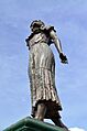
La Marisela Monument in Pedro Camejo
-
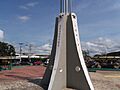
La Bandera Monument in San Fernando


See also
 In Spanish: San Fernando de Apure para niños
