Puketutu railway station facts for kids
Puketutu was once a small railway stop, known as a "flag station," located on the main railway line that runs through the North Island of New Zealand. It was in the Waitomo District, an area known for its caves. This station helped connect communities and transport goods for many years.
Quick facts for kids
Puketutu railway station
|
|||||||||||
|---|---|---|---|---|---|---|---|---|---|---|---|

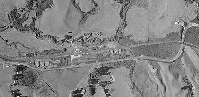
1968 aerial view of Puketutu
|
|||||||||||
| Location | New Zealand | ||||||||||
| Coordinates | 38°25′54″S 175°13′45″E / 38.43175°S 175.22917°E | ||||||||||
| Elevation | 206 m (676 ft) | ||||||||||
| Line(s) | North Island Main Trunk | ||||||||||
| Distance | Wellington 461.83 km (286.97 mi) | ||||||||||
| History | |||||||||||
| Opened | 8 May 1889 | ||||||||||
| Closed | 23 October 1977 | ||||||||||
| Electrified | June 1988 | ||||||||||
| Previous names | Mokau until 11 May 1903 | ||||||||||
| Services | |||||||||||
|
|||||||||||
Puketutu was a "flag station" on the North Island Main Trunk line. This means trains would only stop there if someone waved a flag to get on, or if a passenger on the train asked to get off. It was about 7.21 kilometers (4.48 miles) north of Kopaki and 8.24 kilometers (5.12 miles) south of Waiteti.
Contents
Building the Railway
Building the railway line in this area was a big challenge. Engineers had to figure out the best path through the rugged land. In 1884, they decided on the route. People thought the local forests would provide lots of timber to be carried by the trains for many years.
Most of the railway construction was done by groups of workers who cooperated together. By 1890, the work was advanced enough for government officials to ride horses along the route.
Opening the Line
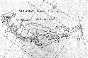
The section of the railway from Te Kūiti to what was then called Mōkau Station (later Puketutu) was finished quickly. It opened on May 8, 1889. For 12 years, Puketutu was the end of the railway line. This was because building the line further south was very difficult.
Work was slow from 1890 to 1892 due to an economic slowdown. The line finally reached the Poro-O-Tarao tunnel in 1901. On May 11, 1903, the station's name was officially changed from Mōkau to Puketutu.
Fencing Issues
When the railway first opened, there were no fences along the tracks to the south of the station. This caused problems, as many farm animals, especially cattle, would wander onto the tracks. This led to animals being killed and trains being delayed. Even though plans for fences were made in 1885, it took a long time for them to be built. Fencing finally started in 1907 and was completed in 1909.
Station Features and Changes
Over the years, Puketutu station saw some additions to help with its operations. In 1924, a special yard for cattle was built. This helped farmers transport their livestock by train. In 1938, a house for railway workers was added near the station.
Future Plans and Electrification
There were ideas to build more railway lines from Puketutu. One idea was a 21-mile (34 km) branch line down the Mōkau valley to Piopio and Aria. However, this plan was voted against in 1922. Another idea was a 10-mile (16 km) extension south to a coal mine at Waitewhena. This mine was eventually served by a different railway line.
The railway line near Puketutu was later made smoother when it was electrified. This means electric trains could use the line, which often makes travel more efficient.
Puketutu railway station officially closed on October 23, 1977.
 | John T. Biggers |
 | Thomas Blackshear |
 | Mark Bradford |
 | Beverly Buchanan |


