Waitomo District facts for kids
Quick facts for kids
Waitomo District
|
|
|---|---|
|
Territorial authority district
|
|
 |
|
 |
|
| Country | New Zealand |
| Region | Waikato region |
| Wards | Te Kuiti Ward Waitomo Rural Ward |
| Seat | Te Kūiti |
| Area | |
| • Land | 3,534.84 km2 (1,364.81 sq mi) |
| Population
(June 2023)
|
|
| • Total | 9,720 |
| Time zone | UTC+12 (NZST) |
| • Summer (DST) | UTC+13 (NZDT) |
| Postcode(s) |
Map of postcodes
|
| Website | waitomo.govt.nz |
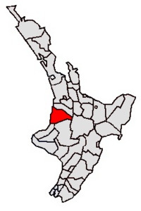
The Waitomo District is a special area in New Zealand, located in the Waikato region on the North Island. It's like a county or a local government area. Most of the district is in the Waikato region, but a small part, called Tiroa, is in the Manawatū-Whanganui region.
This district stretches along the west coast from Te Maika, near Kawhia Harbour, down to Mokau in the south. Inland, it reaches places like Maniaiti / Benneydale and Mount Pureora.
Contents
People and Population in Waitomo
The Waitomo District covers about 3,535 square kilometers. In 2023, about 9,585 people lived here. This means there are only about 2.7 people living in each square kilometer.
The population has been growing steadily. In 2013, there were 8,907 people, and by 2023, it increased to 9,585. The average age of people in Waitomo is 39.4 years.
Who Lives in Waitomo?
People in Waitomo come from many different backgrounds. Here's a look at the main groups:
- About 62.6% are European/Pākehā.
- Around 45.3% are Māori.
- About 4.4% are Pasifika.
- Around 5.0% are Asian.
- A small number are from the Middle East, Latin America, and Africa (0.4%), or other backgrounds (1.3%).
- Some people identify with more than one ethnicity.
Most people in Waitomo were born in New Zealand. About 10.4% of the population was born overseas.
Beliefs and Work
When asked about their beliefs, many people (53.2%) said they had no religion. Others were Christian (31.6%), or had Māori religious beliefs (3.8%). Smaller numbers followed Hinduism, Islam, or Buddhism.
For those aged 15 and older, about 10.8% had a university degree. The average income was $27,300. Many people in Waitomo work full-time (49.8%) or part-time (17.5%).
How Waitomo District is Governed
The main office for the Waitomo District Council is in Te Kūiti. This town had about 4,630 people in 2018. It's the largest town in the district. No other village in Waitomo has more than 500 people.
The Waitomo District was officially created in 1976. The current mayor, who is like the head of the local government, is John Robertson.
What is the Economy Like in Waitomo?
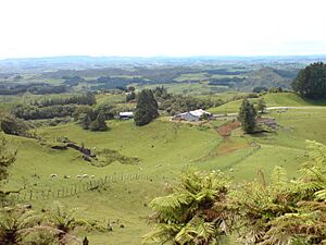
Waitomo is mostly a rural area. This means a lot of the land is used for farming. The main type of farming here is dairy farming, where cows are raised for milk. Sheep farming is also important.
Other big industries in the area include:
- Forestry: Growing and harvesting trees.
- Limestone Quarrying: Digging up limestone, which is a type of rock.
The district is also famous for its natural attractions, which bring in tourists and help the local economy.
Amazing Places to Visit in Waitomo
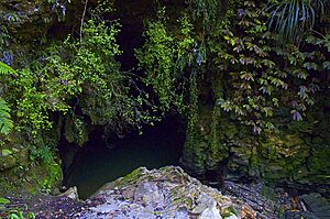
The Waitomo District is well-known for its incredible Waitomo Caves. These are a system of karst caves, which means they are formed in limestone rock. Inside, you can see amazing stalactites (rock formations hanging from the ceiling) and stalagmites (rock formations growing from the floor).
The caves are also famous for their glowworms, which light up the dark spaces like tiny stars! The Waitomo Caves are about 12 kilometers northwest of Te Kūiti.
Near the caves, there's an old and beautiful hotel called the Waitomo Caves Hotel. It was built in 1908 and added to in the 1930s. It looks out over the Waitomo Caves village.
If you drive along Te Anga Road, you'll find even more natural wonders. This winding road takes you past:
- The Waitomo Caves
- The Mangapohue Natural Bridge
- The Piripiri Caves
- The Marokopa Falls
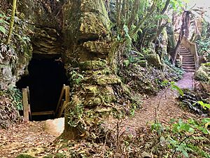
Many other limestone caves are hidden throughout the Waitomo district, waiting to be explored!
See also
 In Spanish: Waitomo para niños
 | James B. Knighten |
 | Azellia White |
 | Willa Brown |


