Purabá facts for kids
Quick facts for kids
Purabá
|
|
|---|---|
|
District
|
|

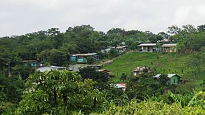
A neighborhood in Purabá de Santa Bárbara
|
|
| Country | |
| Province | Heredia |
| Canton | Santa Bárbara |
| Creation | 2 September 1976 |
| Area | |
| • Total | 6.09 km2 (2.35 sq mi) |
| Elevation | 1,240 m (4,070 ft) |
| Population
(2011)
|
|
| • Total | 4,573 |
| • Density | 750.9/km2 (1,944.8/sq mi) |
| Demonym(s) | Vecino de Purabá, Purabáeño |
| Time zone | UTC−06:00 |
| Postal code |
40406
|
Purabá is a district located in the Santa Bárbara area, within the Heredia province of Costa Rica. It's a part of the country known for its beautiful landscapes. The district is made up of several important neighborhoods, including San Bosco (also called Bosconia), Marías, Purabá, Lajas, and Calle Quirós.
Contents
A Look at Purabá's History
Purabá officially became its own district on September 2, 1976. Before that, it was part of the Santo Domingo district.
Early Days: Indigenous People and Settlers
Long ago, before Spanish settlers arrived, the area of Purabá was home to the Huetares, an indigenous tribe. Their leader, King Cacique Garabito, ruled this land.
In the early 1660s, a settler named Joseph de Sandoval Ocampo started cattle ranches here. One of his ranches was located between what are now San Pedro and Purabá. Later, in the late 1700s, nearby cities like Heredia, Barva, and Alajuela grew. As trade between these cities increased, the Santa Bárbara area, including Purabá, also developed.
Life in the Past
María Cecilia Alfaro Víquez, born in 1940, shared memories of growing up in Purabá. She recalled making dolls from plantain leaves and that the roads were made of dirt and pebbles. Sugarcane farming was very important, and even children made toy sugar mills. In 1949, a new bridge was built in the district, which was a big event for the community.
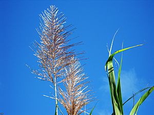
Purabá is the newest district in Santa Bárbara. Its economy has always relied heavily on farming, especially sugarcane, even though sugarcane usually grows better in warmer, lower areas. A large company called Ingenio Agroindustrial Las Marías used to buy farm products here until it moved in 1975.
Purabá's Geography
Purabá covers an area of about 6.09 square kilometers (2.35 square miles). It sits at an elevation of 1240 meters (4068 feet) above sea level.
Mountains and Rivers
Like many parts of Costa Rica, Purabá is in a high-risk zone for natural events. This is because of its mountainous land, which can sometimes lead to landslides and floods. The highest part of Purabá is on the lower slopes of the Barva Volcano, reaching about 2,400 meters (7,900 feet) high. The lowest part, in San Juan, is around 1,000 meters (3,300 feet) high. The Barva volcanic area includes several volcanic cones, so part of Purabá is in the foothills of this volcano.
Several rivers flow through Purabá, including Quebrada Setillal, Rio Ciruelas, Rio Pacayas, and Rio Dorita. In 2010, plans were made to help prevent future natural disasters in the district.
Economy and Business
Purabá has various businesses, such as a pharmacy, restaurants, and local corner stores.
In 2010, the Santa Bárbara canton made plans to improve Purabá's environment. The goal was to help tourism grow. These plans included planting more trees, cleaning rivers, and setting up protected natural areas.
Public Services and Community Life
Health and Religion
An EBAIS, which is a Basic Medical Care Center, is located in the San Bosco neighborhood. It provides health services to everyone in the district. The Catholic Church also serves the area through the Archdiocese of Alajuela. Purabá has a public cemetery that is cared for by the local government.
Electricity and Water
The district gets some of its electricity from the Instituto Costarricense de Electricidad. Like many places, Purabá has sometimes had issues with water supply, even though there are 24 springs and wells nearby. To fix this, the local government planned to improve water delivery and build a water treatment plant before 2020.
Schools and Education
There are three elementary schools in Purabá: Escuela Don Bosco, Escuela Rodolfo Peter Sheider, and Calle Quirós. Plans were made to expand the gyms at Escuela Don Bosco and Escuela Rodolfo Peter Sheider, and to add a computer lab to Escuela Rodolfo Peter Sheider by 2020. These schools also serve as voting places during elections. Most students from Purabá go to Colegio Santa Bárbara High School, but some also attend high schools in Barva or Heredia.
Population of Purabá
| Historical population | |||
|---|---|---|---|
| Census | Pop. | %± | |
| 1984 | 2,070 | — | |
| 2000 | 3,600 | 73.9% | |
| 2011 | 4,573 | 27.0% | |
|
Instituto Nacional de Estadística y Censos |
|||
According to the 2011 census, Purabá had a population of 4,573 people.
Getting Around Purabá
Roads
The district is connected by these main roads:
See also
 In Spanish: Purabá para niños


