Puracé facts for kids
Quick facts for kids Puracé |
|
|---|---|

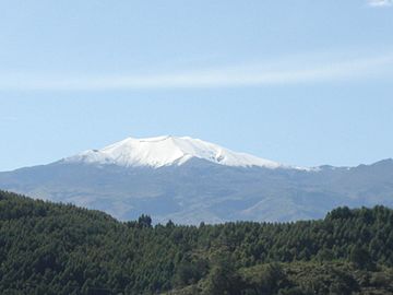
Purace volcano seen from Popayán in 2006
|
|
| Highest point | |
| Elevation | 4,646 m (15,243 ft) |
| Geography | |
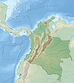
| Location | Cauca |
| Parent range | Central Ranges, Andes |
| Geology | |
| Mountain type | Andesitic stratovolcano |
| Volcanic belt | North Volcanic Zone Andean Volcanic Belt |
| Last eruption | March 1977 |
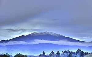
Puracé is a tall, cone-shaped volcano located in the Puracé National Natural Park in the Cauca Department, Colombia. It is known as a stratovolcano, which means it's built up over time by layers of hardened lava, ash, and rocks from many eruptions.
This volcano is part of a large chain of volcanoes called the Andean Volcanic Belt. Specifically, it's in the northern part of this belt, known as the North Volcanic Zone. Puracé sits right where two large cracks in the Earth's crust, called the Coconucos and Morras Faults, meet.
Puracé is one of the most active volcanoes in Colombia. It has erupted many times throughout history.
A History of Eruptions
Puracé has had many powerful eruptions. Some of the biggest ones happened in 1849, 1869, and 1885. In the 20th century, there were about 12 eruptions.
Recent Volcanic Activity
The most recent eruption of Puracé was in March 1977. During this event, volcanic ash traveled about 7 kilometers (4.3 miles) away from the volcano.
Even when it's not erupting, Puracé shows signs of activity. In 1990, scientists saw fumaroles near the top. Fumaroles are vents that release steam and gases from inside the Earth. Also, hot springs, which are natural pools of warm water, come out from the lower parts of the volcano. These signs show that the volcano is still active beneath the surface.
What is a Stratovolcano?
A stratovolcano is a type of volcano that looks like a tall, steep cone. They are built up over many years by layers of lava, ash, and volcanic rock. When these volcanoes erupt, they often have explosive eruptions that send ash and rocks high into the sky. The lava from stratovolcanoes is usually thick and flows slowly, which helps build their steep sides.
The Andean Volcanic Belt
The Andean Volcanic Belt is a major volcanic region that stretches along the Andes mountains in South America. It's part of the larger Pacific Ring of Fire, where many of the world's earthquakes and volcanic eruptions happen. This belt is formed because large pieces of the Earth's crust, called tectonic plates, are moving and colliding. This movement creates pressure and heat, leading to volcanoes like Puracé.
Images for kids
See also
- List of volcanoes in Colombia
- List of volcanoes by elevation
- In Spanish: Volcán Puracé para niños
 | Misty Copeland |
 | Raven Wilkinson |
 | Debra Austin |
 | Aesha Ash |


