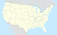
Pushmataha, Alabama facts for kids
Quick facts for kids
Pushmataha, Alabama
|
|
|---|---|
| Country | United States |
| State | Alabama |
| County | Choctaw |
| Elevation | 243 ft (74 m) |
| Time zone | UTC-6 (Central (CST)) |
| • Summer (DST) | UTC-5 (CDT) |
| Area code(s) | 205, 659 |
Pushmataha is a small community in Choctaw County, Alabama, United States. It is an unincorporated community, which means it doesn't have its own local government like a city or town.
The community was named to honor a very important person: Pushmataha. He was a famous chief of the Choctaw Native American tribe. A large part of Pushmataha is special because it's a Historic District. This means it has old buildings and places that are important to history. It was officially added to the Alabama Register of Landmarks and Heritage in October 2008.
Where is Pushmataha?
Pushmataha is located in the state of Alabama. It sits at about 32.19 degrees North and 88.35 degrees West. The community is about 243 feet (or 74 meters) above sea level. This is like saying it's 243 feet higher than the ocean.
How Many People Live There?
The United States government counts how many people live in different places every ten years. This is called a census. In 1880, the census showed that 124 people lived in Pushmataha. This is the only time its population was officially counted.
| Historical population | |||
|---|---|---|---|
| Census | Pop. | %± | |
| 1880 | 124 | — | |
| U.S. Decennial Census | |||
 | Mary Eliza Mahoney |
 | Susie King Taylor |
 | Ida Gray |
 | Eliza Ann Grier |


