Putnam, Kansas facts for kids
Quick facts for kids
Putnam, Kansas
|
|
|---|---|

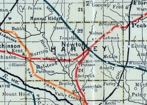
1915 Railroad Map of Harvey County
|
|
| Country | United States |
| State | Kansas |
| County | Harvey |
| Township | Sedgwick |
| Elevation | 1,398 ft (426 m) |
| Time zone | UTC-6 (CST) |
| • Summer (DST) | UTC-5 (CDT) |
| Area code | 620 |
| FIPS code | 20-58025 |
| GNIS ID | 484649 |
Putnam is a small, unincorporated community located in Harvey County, Kansas, in the United States. An "unincorporated community" means it's a place where people live, but it doesn't have its own local government like a city or town. Putnam is found southwest of the city of Newton. You can find it where West Road and SW 60th Street meet, right next to the BNSF Railway train tracks.
A Look Back: Putnam's Past
Putnam once had its own post office. This post office served the community for several years. It was open from 1891 until 1907.
Where is Putnam?
This community is located in the southern part of Harvey County. It is just south of the larger city of Newton. You can find Putnam near the intersection of SW 60th Street and S. West Road. The community was originally built along a railroad line. This railway connected Newton to the city of Wichita.
Learning in Putnam
Students living in the Putnam area attend public schools. The community is part of the Sedgwick USD 439 school district. This district provides education for children in the area.
 | Charles R. Drew |
 | Benjamin Banneker |
 | Jane C. Wright |
 | Roger Arliner Young |


