Pūkio Stream facts for kids
Quick facts for kids Pūkio Stream |
|
|---|---|
|
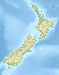
Location of the mouth within New Zealand
|
|
| Physical characteristics | |
| Main source | The Candlesticks Southern Alps |
| River mouth | Esk River Canterbury, New Zealand 43°00′11″S 172°03′09″E / 43.003035°S 172.052632°E |
Pūkio Stream is a small river found in North Canterbury, on the South Island of New Zealand. It starts high up in The Candlesticks mountain range, which is part of the Southern Alps. From there, it flows down until it joins the Esk River.
Even though Pūkio Stream is not very big, it has carved its way through old riverbeds made of gravel. These gravel beds were left behind by glaciers long ago. Near where it meets the Esk River, the stream has cut a deep gorge, about 400-foot-deep (120 m).
How Pūkio Stream's Valley Was Formed
The valley where Pūkio Stream flows is quite wide, much wider than you might expect for a stream its size. This is because the valley sits on top of an old crack in the Earth's crust, called a fault. Long ago, this wide valley was actually the path of a much larger river, the Cox River.
The Role of Ancient Glaciers
During the Pleistocene Ice Age, huge glaciers covered much of the land. A glacier called the Cox glacier moved through this area. As it melted, it left behind large piles of rock and dirt called terminal moraines. These moraines acted like a dam, blocking the Cox River's original path.
Because its path was blocked, the Cox River had to find a new way to flow. It ended up changing its course and now flows into the Poulter River instead. One of the biggest moraines left by the Cox glacier is known as the Lochinvar moraine, which is also sometimes called the Misery Mounds.
Carving the Gorge
The deep gorge that Pūkio Stream flows through near its end was created over a very long time. The stream has slowly worn away the loose, rocky material left by the glaciers. Below these loose layers, the stream has also cut into the solid rock underneath, which is a type of rock called greywacke. This process of erosion continues to shape the valley today.
 | James B. Knighten |
 | Azellia White |
 | Willa Brown |


