Qikiqtaryuaq facts for kids

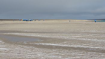
Adventure Canada tourists exploring Jenny Lind Island, 2019
|
|
| Geography | |
|---|---|
| Location | Queen Maud Gulf |
| Coordinates | 68°43′17″N 102°02′12″W / 68.72139°N 102.03667°W |
| Archipelago | Arctic Archipelago |
| Area | 420 km2 (160 sq mi) |
| Highest elevation | 80 m (260 ft) |
| Administration | |
|
Canada
|
|
| Nunavut | Nunavut |
| Region | Kitikmeot |
| Demographics | |
| Population | Uninhabited |
Qikiqtaryuaq, also known as Jenny Lind Island, is a small island in Canada's Arctic. It is named after Jenny Lind, a famous opera singer from Sweden. This island covers about 420 km2 (160 sq mi) and is part of the Kitikmeot Region in Nunavut.
You can find Qikiqtaryuaq in the Queen Maud Gulf. It's located about 120 km (75 mi) southeast of Cambridge Bay. The island is currently uninhabited by people.
This island was once home to a site called CAM-1A, which was part of the Distant Early Warning Line. Today, it hosts an unmanned North Warning System site, which helps monitor the Arctic skies.
Island Geography
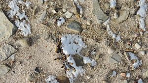
Qikiqtaryuaq has a varied landscape. You'll find rocky ridges and low, wet areas called wetlands. There are also sedge meadows, which are grassy areas, and sandy shorelines along the coast.
Island Wildlife
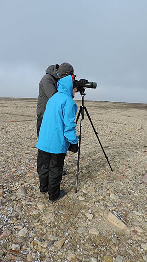
Qikiqtaryuaq is a very important place for birds. It's recognized as a Canadian Important Bird Area and a Key Migratory Terrestrial Bird Site. This means many birds stop here during their long journeys.
Some of the birds you might see include:
- Canada goose
- Lesser snow goose
- Ross's goose
Besides birds, you can also find Muskoxen on the island. These large, shaggy animals live in the southeastern part of Qikiqtaryuaq.
Island Climate
The climate on Qikiqtaryuaq is typical for the Arctic. It has very cold winters and cool, short summers. The weather data below shows the average temperatures and precipitation for the island.
| Climate data for Jenny Lind Island Airport (1961-1990) | |||||||||||||
|---|---|---|---|---|---|---|---|---|---|---|---|---|---|
| Month | Jan | Feb | Mar | Apr | May | Jun | Jul | Aug | Sep | Oct | Nov | Dec | Year |
| Record high °C (°F) | −5.1 (22.8) |
−8.8 (16.2) |
−7.8 (18.0) |
2.8 (37.0) |
6.1 (43.0) |
18.3 (64.9) |
22.8 (73.0) |
20.6 (69.1) |
15.0 (59.0) |
6.0 (42.8) |
0.6 (33.1) |
−2.8 (27.0) |
22.8 (73.0) |
| Mean daily maximum °C (°F) | — | — | −26.1 (−15.0) |
−17.3 (0.9) |
−5.8 (21.6) |
3.2 (37.8) |
9.6 (49.3) |
7.2 (45.0) |
1.0 (33.8) |
−7.5 (18.5) |
−19.2 (−2.6) |
−25.1 (−13.2) |
— |
| Daily mean °C (°F) | — | — | −29.9 (−21.8) |
−21.6 (−6.9) |
−9.3 (15.3) |
0.7 (33.3) |
6.1 (43.0) |
4.5 (40.1) |
−0.9 (30.4) |
−10.4 (13.3) |
−22.7 (−8.9) |
−28.6 (−19.5) |
— |
| Mean daily minimum °C (°F) | −37.2 (−35.0) |
−37.4 (−35.3) |
−34.6 (−30.3) |
−26.1 (−15.0) |
−13.0 (8.6) |
−1.9 (28.6) |
2.6 (36.7) |
1.7 (35.1) |
−3.0 (26.6) |
−13.6 (7.5) |
−26.7 (−16.1) |
−33.2 (−27.8) |
−18.5 (−1.3) |
| Record low °C (°F) | −51.2 (−60.2) |
−51.2 (−60.2) |
−50.0 (−58.0) |
−43.3 (−45.9) |
−30.6 (−23.1) |
−17.2 (1.0) |
−2.8 (27.0) |
−7.8 (18.0) |
−16.7 (1.9) |
−33.2 (−27.8) |
−42.8 (−45.0) |
−47.2 (−53.0) |
−51.2 (−60.2) |
| Average precipitation mm (inches) | 2.2 (0.09) |
2.4 (0.09) |
2.7 (0.11) |
3.9 (0.15) |
5.9 (0.23) |
10.6 (0.42) |
19.6 (0.77) |
25.9 (1.02) |
18.6 (0.73) |
14.0 (0.55) |
5.5 (0.22) |
3.0 (0.12) |
114.3 (4.50) |
| Source: 1961-1990 Environment Canada | |||||||||||||
Island History
Even though no people live on Qikiqtaryuaq today, it has an interesting history. It was once part of the Distant Early Warning Line, often called the DEW Line. This was a system of radar stations built during the Cold War to detect incoming aircraft. The site on Jenny Lind Island was known as CAM-1.
Today, the island still plays a role in monitoring the Arctic through the active North Warning System.
See also
 In Spanish: Isla Jenny Lind para niños
 | Madam C. J. Walker |
 | Janet Emerson Bashen |
 | Annie Turnbo Malone |
 | Maggie L. Walker |


