Quảng Trị province facts for kids
Quick facts for kids
Quảng Trị Province
Tỉnh Quảng Trị
|
|
|---|---|
|
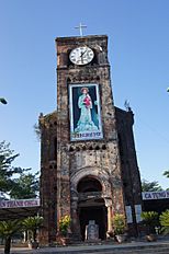
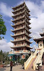
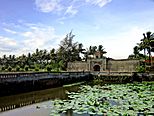
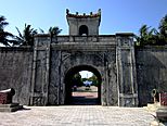
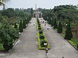
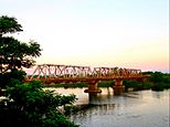
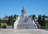
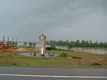
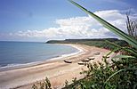
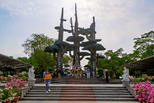
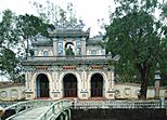
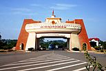
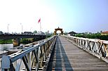
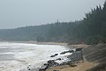
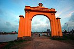
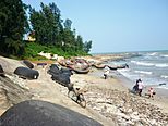
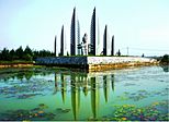
La Vang cathedral • Cam Lộ Temple • Quảng Trị ancient wall • Thạch Hãn bridge • Giao Bưu statue • Monument of three banyan trees • Cửa Tùng beach • Tịnh Quang Temple • Lao Bảo border checkpoint • Hiền Lương bridge • Bến Hải beach • Hiền Lương gate • Vịnh Mốc beach • Khát Vọng monument
|
|
| Nickname(s):
Serenity under Reign
|
|
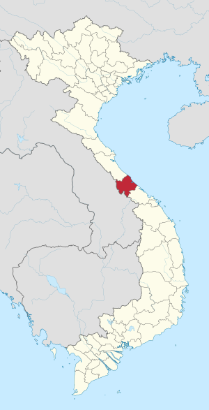
Location of Quảng Trị within Vietnam
|
|
| Country | |
| Region | North Central Coast |
| Capital | Đông Hà |
| Area | |
| • Total | 4,745.7 km2 (1,832.3 sq mi) |
| Population
(2021)
|
|
| • Total | 701,375 |
| • Density | 147.7917/km2 (382.779/sq mi) |
| Demographics | |
| • Ethnicities | Vietnamese, Bru, Hoa, Tà Ôi |
| Time zone | UTC+7 (ICT) |
| Area codes | 233 |
| ISO 3166 code | VN-25 |
Quảng Trị is a province located in the central part of Vietnam. It's a coastal area, meaning it has a beautiful shoreline along the South China Sea, also known as the East Sea. To the north, it shares a border with Quảng Bình province, and to the south, with Thừa Thiên Huế. To the west, it meets Laos, a neighboring country. Quảng Trị has about 75 kilometers (about 47 miles) of coastline.
Contents
Geography and Climate
Most of Quảng Trị province is covered by hills and the Annamite Mountains. Only a small part near the coast is flat.
The highland areas have steep slopes and narrow valleys. These areas are mostly covered by thick, green forests. Many peaks are very tall, some reaching over 2,400 meters (8,000 feet) high. The flat coastal areas next to the highlands have sandy beaches and some rocky parts. Where the soil is good, there are also rice fields.
Rivers in Quảng Trị flow in two main directions. Some flow east towards the East Sea, taking short paths through deep valleys. Others flow west into Laos, following longer paths, sometimes through deep canyons. These rivers can flood during certain seasons.
The weather in Quảng Trị is a tropical monsoon climate. This means it has a wide range of temperatures and rainfall. From May to September, it's hot and dry with winds from the southwest. From November to mid-March, it's cooler and rainy. The average temperature is about 24°C (75°F), but it can get as cold as 7°C (45°F) during the rainy season.
History of Quảng Trị
In ancient times, the lowlands of Quảng Trị were home to the Cham people. They spoke a different language and had a unique culture compared to the Vietnamese people further north.
Around the 3rd century BCE, the Qin dynasty of China took control of parts of Central Vietnam, including this area. They ruled the local people for several centuries. However, in the 2nd century CE, the Cham people rebelled and took back control.
Later, in the 14th and 15th centuries, Vietnamese armies defeated the Cham people in this region. Over time, more Vietnamese people moved in, and some Cham people either left or blended into the Vietnamese culture. This led to a special Vietnamese dialect and culture developing in the area.
In 1874, the French took control of the region. By 1887, it became part of French Indochina, specifically the Annam protectorate.
Quảng Trị During the Vietnam War
In 1954, Vietnam was divided into North and South. Quảng Trị became the northernmost province of South Vietnam. The Vietnamese Demilitarized Zone, a neutral area, was located within the province.
Starting in 1964, Quảng Trị became an important area for American military bases. In 1966, North Vietnamese forces also began moving into the northern parts of the province.
Quảng Trị City, the provincial capital, saw a lot of fighting. It was briefly taken over by North Vietnamese troops in April 1967. During the 1968 Tet Offensive, it was again a major battleground. North Vietnamese troops held it for a short time before South Vietnamese and U.S. forces recaptured it. The Battle of Khe Sanh in 1968 was also part of North Vietnam's efforts to control the province.
In 1972, North Vietnamese forces managed to capture Quảng Trị City in the First Battle of Quảng Trị. However, South Vietnamese forces launched a counter-attack from June to September 1972 in the Second Battle of Quảng Trị, taking back much of the lost territory.
Clearing Explosives After the War
After the war, many unexploded bombs and mines were left behind. These are called unexploded ordnance (UXO). Since 1999, organizations like Mines Advisory Group (MAG International) have been working in Quảng Trị to clear these dangerous explosives.
Another group, Roots of Peace, works with MAG. They clear areas of mines and then help local farmers plant valuable crops. This helps the land become safe and useful again.
Administrative Divisions
Quảng Trị province is divided into several smaller areas for local government. These include:
- 8 districts:
- Cam Lộ
- Cồn Cỏ
- Đa Krông
- Gio Linh
- Hải Lăng
- Hướng Hóa
- Triệu Phong
- Vĩnh Linh
- 1 district-level town:
- Quảng Trị
- 1 provincial city:
- Đông Hà (which is the capital of the province)
These areas are further divided into smaller towns, communes (like small rural communities), and wards (parts of a city).
Organizations Helping Quảng Trị
Many non-governmental organizations (NGOs) are active in Quảng Trị. A big focus for them is dealing with the explosive remnants of war (ERW) left over from conflicts. Here are some of the main NGOs helping with this important work:
- Clear Path International (CPI)
- Mines Advisory Group (MAG)
- PeaceTrees Vietnam (PTVN)
- Project RENEW ("Restoring the Environment and Neutralizing the Effects of the War")
- Roots of Peace (RoP)
Transportation
Getting around Quảng Trị is made easier by several important routes:
- The National Route 1 runs from north to south through the province.
- The Vietnam–Laos road goes from west to east and connects with National Route 1A.
- The Hanoi–Saigon Railway also passes through Quảng Trị.
- A new airport, Quảng Trị Airport, is planned to be built about 7 kilometers (4.3 miles) north of Đông Hà.
Etymology
The name "Quảng Trị" comes from words in Sino-Vietnamese. These words mean "wide" or "broad" (Quảng) and "govern" or "rule" (Trị).
See also
 In Spanish: Provincia de Quảng Trị para niños
- Bến Hải River
 | Calvin Brent |
 | Walter T. Bailey |
 | Martha Cassell Thompson |
 | Alberta Jeannette Cassell |


