Quảng Bình province facts for kids
Quick facts for kids
Quảng Bình province
Tỉnh Quảng Bình
|
|
|---|---|
|
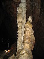
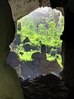
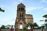
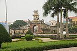
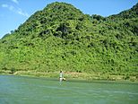
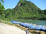
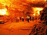
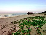
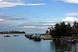
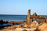
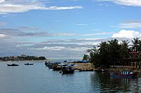
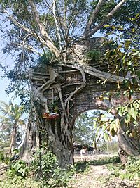
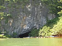
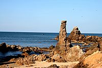
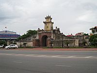
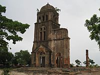
Hang Sơn Đoòng • Cathedral Tam Tòa • Đồng Hới Citadel • Son River • Bang Spa • Phong Nha – Kẻ Bàng National Park • Bảo Ninh Beach • Đình Ba Đồn • Nhật Lệ Beach • Nhật Lệ River • Đá Nhảy Beach
|
|
| Nickname(s):
Serenity
|
|
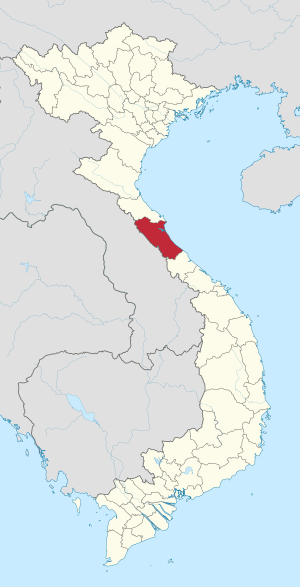
Location of Quảng Bình within Vietnam
|
|
| Country | |
| Region | North Central Coast |
| Capital | Đồng Hới |
| Area | |
| • Total | 8,065.8 km2 (3,114.2 sq mi) |
| Population
(2021)
|
|
| • Total | 1,003,430 |
| • Density | 124.4055/km2 (322.209/sq mi) |
| Demographics | |
| • Ethnicities | Vietnamese, Bru, Chứt, Tày |
| Time zone | UTC+07:00 (ICT) |
| Area codes | 232 |
| ISO 3166 code | VN-24 |
Quảng Bình is a coastal province in the central part of Vietnam. It is part of the North Central Coast region. The province shares borders with Hà Tĩnh to the north and Quảng Trị to the south. To the west, it borders Khammouane in Laos. To the east, it faces the East Sea (also known as the Gulf of Tonkin).
Quảng Bình used to be called Tiên Bình. It was renamed Quảng Bình in 1604. The province covers an area of about 8,065.8 square kilometers. In 2008, it had a population of 857,818 people. This area was once part of the ancient kingdom of Champa. It later became part of Đại Việt, which was an old name for Vietnam.
Quảng Bình was a key battleground between Champa and Vietnam for many years. It became very important when Nguyễn Hoàng, a prince, was sent to the south. He built his base here. During the Vietnam War, Quảng Bình was heavily bombed. This was because it was very close to the dividing line between North and South Vietnam. Today, it is home to the famous Phong Nha-Kẻ Bàng National Park, a World Heritage site. Many famous Vietnamese people come from Quảng Bình. These include General Võ Nguyên Giáp and writer Bảo Ninh.
Contents
Quảng Bình Province
Geography
Location and Size
Quảng Bình is located between 16°55’ and 18°05’ North. It is also between 105°37’ and 107°00’ East. The province borders Hà Tĩnh province in the north. The Ngang mountain pass forms a natural boundary there. To the south is Quảng Trị province. Laos is to the west, and the East Sea is to the east. At its narrowest point, the province is only 40 kilometers wide. This is from the sea to the Laotian border.
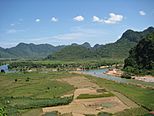
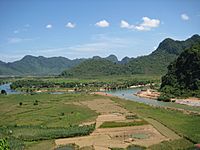
The land in Quảng Bình slopes from west to east. It is higher in the west and lower near the coast. Hilly and mountainous areas make up 85% of the province. The Annamite Range forms a natural border with Laos. Its peaks are usually between 1,000 and 1,500 meters high. The highest point is Phi Co Pi peak, which is 2,017 meters tall. Closer to the east, there are lower hills and flat plains. A belt of sand dunes along the coast protects the land from ocean tides.
The total land area is 8,037.9 square kilometers.
- Land where people live: 41.45 square kilometers.
- Farm land: 1635.46 square kilometers.
- Forests: 4912.62 square kilometers.
- Special use land: 199.36 square kilometers.
- Unused land: 26.01 square kilometers.
Sand areas make up 5.9% of the land. Rich, fertile soil is only 2.8% of the land. The coastline is 116.04 kilometers long. The border with Laos is 201.81 kilometers long. The province has 4866.88 square kilometers of forests. Most of this is natural jungle.
Rivers and the Sea
Quảng Bình has five main rivers. These include the Gianh River, which was once a border. It divided Vietnam into two parts during a past war. Other rivers are the Ron River and the Nhật Lệ River. The Nhật Lệ River is where the Kiến Giang and Long Đại rivers meet. The Ly Hoa and Dinh rivers are also important.
Most rivers start in the Truong Son Range. They flow into the sea. There are about 160 natural and man-made lakes. They hold 234.3 million cubic meters of fresh water. Quảng Bình also has a large sea area. This includes a continental shelf and a special economic zone. This area is about 20,000 square kilometers. There are several small islands off the coast. These include Hòn La and Hòn Gió. They have a total fishing capacity of 100,000 metric tons. Hòn La bay is a good place for a deep-water port.
Mountains
The Hoành Sơn Mountains run through the northeast of the province. Many mountain peaks are found in the Phong Nha-Kẻ Bàng area. Many of these peaks are over 1,000 meters high. Notable peaks include Co Rilata (1,128 m) and Co Preu (1,213 m). Mountains in the park's karst area are typically above 800 meters. They form a continuous range along the border with Laos.
Weather
Quảng Bình has four distinct seasons. From February to April, it is spring. It is warm with light rains and humid air. Temperatures are usually between 18 and 25 degrees Celsius. Summer is from May to July. It is hot and dry with few rain showers. Temperatures can reach 35 to 36 degrees Celsius. In the fall, it is rainy and cool. The temperature is around 22 to 28 degrees Celsius. Winter is humid with light rain. Temperatures are about 12 to 16 degrees Celsius.
The province gets about 2,000-2,300 mm of rain each year. The heaviest rain is from September to November. The dry season is from April to August. The hottest months are June, July, and August.
Nature and Animals
Plants and Trees
Quảng Bình province has a rich variety of plants and animals. This is especially true in the Annamite Range area. Surveys in Phong Nha-Kẻ Bàng show many plant species. There are 751 species of vascular plants. Of these, 36 are endangered. They are listed in Vietnam's Red Data Book. Common trees include Hopea sp. and Chukrasia tabularis. New plants grow slowly here. This is because they need soil to gather in cracks in the limestone.
The forests in the national park have mostly evergreen trees. There are also some deciduous trees that lose their leaves. The most common plant families are Lauraceae and Fabaceae. Some gymnosperms like Podocarpus imbricatus are also found.
The park has a large forest of Calocedrus macrolepis trees. This forest covers 5,000 hectares. Most of these trees are 500–600 years old. This is the largest forest of its kind in Vietnam. Biologists have also found three rare orchid species here. These include Paphiopedilum malipoense and Paphiopedilum dianthum. These orchids are considered endangered.
Animals
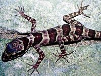
The forests of Quảng Bình are home to many animals. Especially in Phong Nha-Kẻ Bàng, there are at least 381 species of vertebrates. 66 animal species are listed in Vietnam's Red Data Book. Another 23 species are on the World Red Book of Endangered Species. In 2005, a new type of gecko was found here. It was named Lygosoma boehmeiwas.
Scientists have also discovered the gaur and a new type of eel. Ten new species, never seen before in Vietnam, were found in the park. Phong Nha-Kẻ Bàng has a large number of primates. There are ten species and subspecies. These include the pig-tailed macaque and the white-cheeked crested gibbon. The park has one of the largest groups of François' langur in Vietnam. It is also known for its Hatinh and black langurs.
Ten species of bats listed as threatened are found here. Of 59 reptile and amphibian species, 18 are in Vietnam's Red Data Book. 6 are on the IUCN Red List. There are 72 fish species. Four of these are found only in this area. One example is Danio quangbinhensis.
The park is home to over 200 bird species. These include rare birds like the chestnut-necklaced partridge and the red-collared woodpecker. A survey by Russian and Vietnamese scientists found 259 butterfly species. Almost all major types of butterflies in Vietnam can be found in Phong Nha-Kẻ Bàng.
How the Province is Organized
Quảng Bình is divided into 8 main areas.
- 6 districts:
- Bố Trạch
- Lệ Thủy
- Minh Hóa
- Quảng Ninh
- Quảng Trạch
- Tuyên Hóa
- 1 district-level town:
- Ba Đồn (created in 2013)
- 1 provincial city:
- Đồng Hới (this is the capital city)
These areas are further divided into smaller towns and communes. There are 7 townlets, 136 communes, and 16 wards. Each of these smaller units has a local leader. They also have a people's council and a people's committee. These groups help manage daily life.
Culture and Learning
Quảng Bình is home to Quảng Bình University. This university was once a college. It now has departments for business, teaching, and computer science. There are also many high schools and primary schools. People in Quảng Bình value education highly. They see it as a way to improve their lives and fight poverty.
The province has a rich culture. It is known for its famous people. An old archaeological site called Bàu Tró is here. Ancient bronze drums from the Dong Son culture were found there. In 2007, an old pot of coins was found buried in a rice field. These coins were from the Tang dynasty.
Compared to richer provinces, Quảng Bình is not as wealthy. Many young, educated people move to bigger cities for work. Each commune has a clinic. Every county has a hospital. Đồng Hới city has more hospitals. The Đồng Hới Hospital was a gift from Cuba.
Economy
The average income per person in Quảng Bình is lower than Vietnam's average. The main industries are making building materials. This includes cement, tiles, and bricks. This is because the province has a lot of limestone and white clay. Quảng Bình has two industrial parks. One is in Đồng Hới city, and the other is in Hon La bay. Processing seafood, making bio-fertilizer, and producing aluminum are also important.
More than 80% of the people work in farming. In recent years, tourism has grown a lot. This is thanks to Phong Nha-Kẻ Bàng National Park and its beautiful beaches. Trade with Laos happens through the Cha Lo gate. In 2005, the province's exports were only 30 million US dollars. This was a small part of Vietnam's total exports.
Farming in the province has improved. Farmers are now growing more crops to sell. Food production has increased. In 2000, it reached 200,000 tons. The area for industrial trees is 14,105 hectares. This includes 6,400 hectares of rubber trees. Animal farming is also growing. The amount of forest has increased. This is to protect natural resources. About 4,000 hectares of new forest are planted each year.
Fishing is also a key part of the economy. The province has about 3,200 fishing boats. In 2000, they caught about 17,104 tons of seafood. There are also shrimp and fish farms. The province has factories that process frozen and dried seafood for export. However, the fishing industry has not reached its full potential.
As of 2008, Quảng Bình had 59 investment projects. These were worth 500 million US dollars. In 2009, the province had two special economic zones. These zones offer benefits for businesses. They are the Hòn La Economic Zone and the Cha Lo Border Gate Economic Zone.
Fun Places to Visit
Quảng Bình has many places that are great for tourists.
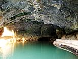
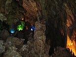
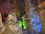
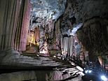
- Phong Nha-Kẻ Bàng National Park: This park is famous for its karst region. It covers over 200,000 square kilometers. This park became a UNESCO World Heritage site in 2003. It is located in the Bố Trạch and Minh Hóa districts. The park protects one of the world's largest karst areas. It has about 300 caves and grottoes. It also protects the unique ecosystem of the limestone forest.
Phong Nha-Kẻ Bàng is known for its cave systems. These caves have a total length of about 70 kilometers. Only 20 of them have been explored by scientists. Phong Nha holds several world records for caves. It has the longest underground river. It also has the largest caverns and passages. After the park became a UNESCO site, more tourists started visiting. People mainly visit Phong Nha, Tien Son, and Thiên Đường caves. Sơn Đoòng Cave is not yet open to visitors.
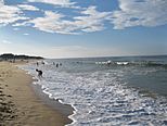
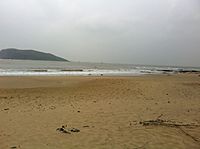
- Đá Nhảy, Ly Hoa, and Nhật Lệ beaches: These beaches have beautiful white sand and clean water. They are some of the most attractive beaches in Vietnam.
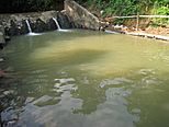
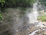
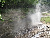
- Bang Spa: This is a hot spring area in Lệ Thủy District. It offers resorts and health services. The water from the springs can be as hot as 105 degrees Celsius.
- Ho Chi Minh trail: Many important sites from the Vietnam War are found along this historic trail.
The amazing natural beauty of Quảng Bình was used in the movie Kong: Skull Island.
Getting Around
Quảng Bình has good transportation. It has an airport, a seaport, roads, railways, and rivers. Đồng Hới Airport has flights to major cities in Vietnam. These include Hanoi and Ho Chi Minh City. In 2017, international flights to Chiang Mai, Thailand, also started. The province has two national highways: National Route 1A and Ho Chi Minh Highway. The North–South railway also runs through the province.
The Cha Lo Border Gate Economic Zone connects to Laos. The Hon La deep-water seaport can handle large ships. National Road 12A connects the Hon La seaport to the Cha Lo Border Gate. This road links to Thailand, Myanmar, and other Southeast Asian countries. Quảng Bình is an important point for trade in the region.
People of Quảng Bình
The population of Quảng Bình was 882,500 in 2016. There are 24 different ethnic groups living here. The main group is the Kinh people. Other groups include the Vân Kiều and Chứt. Most of the ethnic minority groups live in the mountainous areas. The province has many different Vietic languages spoken. These include Vietnamese, Nguồn, Arem, Maleng, and Chứt.
Most of the people live in a small part of the province. Over 90% of the population lives on about 10% of the land. Only 10% of the people live in the mountains and sandy areas. About 80% of the people live in rural areas. The rest live in cities. In 2000, about 47% of the people were working. Most of them worked in farming.
History of Quảng Bình
Archaeological digs show that people lived in Quảng Bình during the Stone Age. Many old items like ceramic vases and stone tools have been found. In 1926, a French archaeologist found many artifacts in caves in western Quảng Bình. She believed they belonged to the Hòa Bình culture. These items are about 10,509 years old.
The Hum grotto and Khai grotto also contain old stone tools. Some ceramics from the Đông Sơn culture were found too. People in the Stone Age lived in caves and hunted for food.
Under the Hung kings, Quảng Bình was part of the Việt Thường group. Later, it was called Tiên Bình. The central and southern parts of Vietnam were once part of the Champa Kingdom. Wars between Champa and Đại Việt were common. Quảng Bình became part of Đại Việt in 1306 AD. This happened after a royal marriage.
During the Trinh-Nguyễn family war in the 17th century, the Gianh River in Quảng Bình became a border. It divided Vietnam into two parts. Đồng Hới city was built as a fortress to protect the southern part. In 1604, the province was named Quảng Bình.
During the time of French rule, Quảng Bình was part of Annam. The French used Đồng Hới airbase. In 1954, Vietnam was temporarily divided into two parts. The 17th parallel was the boundary. Quảng Bình was in North Vietnam. During the Vietnam War, Quảng Bình was heavily bombed. This was because of its location near the dividing line. In 1976, Quảng Bình was merged with two other provinces. But in 1990, it became a separate province again.
Notable People
- Ngô Đình Diệm (1901-1963), a former President of South Vietnam.
- Pierre Van Vien Nguyen (born 1965), a Vietnamese Roman Catholic leader.
See also
 In Spanish: Provincia de Quảng Bình para niños
 | Emma Amos |
 | Edward Mitchell Bannister |
 | Larry D. Alexander |
 | Ernie Barnes |


