Quartzburg, Idaho facts for kids
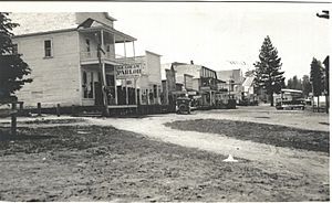
Quartzburg is a small, historic town in Boise County, Idaho. It is not officially a city anymore, but it has a rich past.
Contents
History of Quartzburg
Quartzburg began as a busy mining town. It had its own post office starting in 1874. The post office closed in 1940.
What's in a Name?
The town's name has changed a few times. It was first called Quartzburg. In 1894, its name changed to Quartzburgh. Later, it went back to being called Quartzburg.
Where is Quartzburg?
Quartzburg is located in a special area called the Boise Basin. This basin is a valley surrounded by mountains in central Idaho. It is separated from the Snake River plains by a hill range called Boise Ridge. Tall mountains are to its east and south.
The rocks in this area are mostly from a time called the Cretaceous period. This was about 66 to 145 million years ago.
All About Quartz
Quartz is a very common mineral. Its chemical formula is SiO2. This means it's made of silicon and oxygen.
When hot, watery fluids move through rocks, they can dissolve quartz. As these fluids cool down, the quartz can form again. It often fills cracks in rocks, creating thin white lines or large veins. These veins can stretch for many kilometers. Sometimes, these veins contain beautiful quartz crystals.
Hot fluids can also come from cooling magma (melted rock). When these hot, salty fluids enter cooler rocks, quartz can form.
Gold Deposits in Mountains
Gold deposits that form during mountain building are called "orogenic gold deposits." These usually form deep inside the Earth, about 5 to 15 kilometers down. They happen in areas where Earth's plates are pushing together. This pushing helps hot, gold-rich fluids move up from deep underground.
Earthquakes can help these fluids rise quickly. As the fluids move up, they cool down and change pressure. This causes the gold to separate from the fluid and form deposits. Gold can also form when these fluids react with rocks or mix with other fluids.
Nearby Towns and Roads
In the late 1800s and early 1900s, Quartzburg was an important gold mining center. Other key towns were Idaho City, Centerville, Placerville, and Pioneerville.
All these towns were connected by roads. Several roads also led to places outside the area. Idaho City, the main town in the county, was connected to Boise by a 32-mile road.
- A road called Harris Creek Road (once the Hawkins toll road) connected Placerville and Horseshoe Bend. It crossed a ridge at 5,500 feet high.
- Alder Creek Road connected Garden Valley to Placerville.
- Pioneerville was connected to Garden Valley by a road over Grimes Pass.
- East of Idaho City, a road crossed a divide to reach the Edna and Banner silver mines.
Early Railroads
The Barber Lumber Company started in 1902. It was a big company that employed many people. They built a wooden dam on the Boise River. This dam helped them float logs and power their sawmill.
The company had a sawmill, a planing mill, a box factory, and a lumber yard. They also had their own railroad, called the Intermountain Railroad. This railroad helped move timber and supplies. It served the Boise Basin and mining towns like Quartzburg. The Barber sawmill closed in 1935.
Local Mines
Last Chance Mine
The Last Chance Mine was a gold mine in Boise County. It was located at an elevation of 4,902 feet. In 1899, three men owned the mine: O.J. Daly, Henry Beary, and George Faull.
Gold Hill Mine
The Gold Hill Mine was another important mine. After a fire destroyed its mill and the town in 1938, the mine was no longer used.
Geology of the Area
Northeast of Quartzburg, there is a special area of rocks called a porphyry belt. This belt is made up of different types of rocks. These include quartz diorite, granite porphyry, diorite, and rhyolite.
 | Bessie Coleman |
 | Spann Watson |
 | Jill E. Brown |
 | Sherman W. White |


