Quartzville Creek facts for kids
Quick facts for kids Quartzville Creek |
|
|---|---|

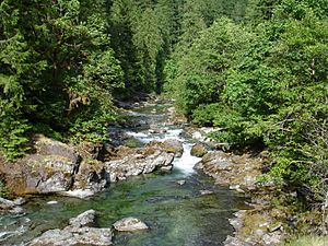
Flowing through the forest
|
|
|
Location of the mouth of Quartzville Creek in Oregon
|
|
| Country | United States |
| State | Oregon |
| County | Linn |
| Physical characteristics | |
| Main source | Willamette National Forest, Cascade Range 4,094 ft (1,248 m) 44°34′20″N 122°07′38″W / 44.57222°N 122.12722°W |
| River mouth | Middle Santiam River Green Peter Reservoir 1,014 ft (309 m) 44°28′34″N 122°30′04″W / 44.47611°N 122.50111°W |
| Length | 28 mi (45 km) |
| Basin features | |
| Basin size | 171 sq mi (440 km2) |
| Type: | Recreational |
| Designated: | October 28, 1988 |
Quartzville Creek is a beautiful river in Oregon, USA. It flows for about 28 miles (45 km) through Linn County before joining the Middle Santiam River. People love to visit Quartzville Creek for fun outdoor activities like camping, fishing, hunting, kayaking, and even searching for gold!
A special part of the creek, about 12 miles (19 km) long, is protected as a "Wild and Scenic" river. This means it's kept very natural and wild for everyone to enjoy. The creek gets its name from an old gold-mining town called Quartzville, which used to be nearby.
About Quartzville Creek
Quartzville Creek starts high up in the Cascade Range mountains, about 4,100 feet (1,200 meters) above sea level. It flows mostly west and southwest through the Willamette National Forest. Along its journey, many smaller streams join it, adding to its flow.
The creek is followed by a road called Quartzville Back Country Byway. This road makes it easy for people to explore the area and find great spots for recreation. You can find places like Yellowbottom Campground and Dogwood Picnic Area right along the creek. There's also a pretty spot called Cascade Falls, where a small stream tumbles into the creek.
Eventually, Quartzville Creek flows into a northern part of Green Peter Reservoir. This reservoir is a large lake formed by a dam. From there, the water continues its journey, eventually joining the South Santiam River.
How Much Water Flows?
Scientists keep track of how much water flows in Quartzville Creek. They have a special station about 6.6 miles (10.6 km) from where the creek meets the reservoir. This helps them understand the creek's health and how it changes over time.
On average, the creek carries about 652 cubic feet (18.5 cubic meters) of water every second. That's like filling a small swimming pool in just a few seconds! The most water ever recorded flowing through the creek was a huge amount: 23,700 cubic feet (671 cubic meters) per second. This happened during a big flood in February 1996. The least amount of water recorded was only 14 cubic feet (0.40 cubic meters) per second, during a very dry period in August 1973.
Even bigger floods have happened. In December 1964, it's estimated that the creek had an even larger flow of 36,500 cubic feet (1,030 cubic meters) per second. These big floods show how powerful rivers can be, especially after heavy rains or melting snow.
 | Kyle Baker |
 | Joseph Yoakum |
 | Laura Wheeler Waring |
 | Henry Ossawa Tanner |


