Rainbow City, Arizona facts for kids
Quick facts for kids
Rainbow City, Arizona
|
|
|---|---|

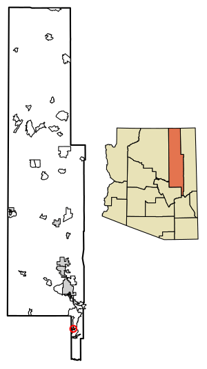
Location of Rainbow City in Navajo County, Arizona.
|
|
| Country | United States |
| State | Arizona |
| County | Navajo |
| Area | |
| • Total | 2.18 sq mi (5.64 km2) |
| • Land | 2.18 sq mi (5.64 km2) |
| • Water | 0.00 sq mi (0.00 km2) |
| Elevation | 5,781 ft (1,762 m) |
| Population
(2020)
|
|
| • Total | 1,001 |
| • Density | 459.81/sq mi (177.51/km2) |
| Time zone | UTC-7 (MST (no DST)) |
| ZIP code |
85941
|
| Area code(s) | 928 |
| FIPS code | 04-58620 |
| GNIS feature ID | 2582847 |
Rainbow City is a small community in Navajo County, Arizona. It is located in the United States, specifically on the Fort Apache Indian Reservation. This area is known as a census-designated place (CDP). A CDP is a place that looks like a town but isn't officially governed as one.
In 2010, the population of Rainbow City was 968 people. By the year 2020, the number of people living there grew to 1,001.
Contents
About Rainbow City
Rainbow City is found in the eastern part of Arizona. It's part of Navajo County, which is one of the largest counties in the state. The community is located within the boundaries of the Fort Apache Indian Reservation. This reservation is home to the White Mountain Apache Tribe.
What is a Census-Designated Place?
A census-designated place (CDP) is a special type of area. It is created by the United States Census Bureau for gathering information. CDPs are like towns or villages that don't have their own local government. They are not officially incorporated as cities or towns.
Even without a city government, people live and work in CDPs. The Census Bureau collects data on them. This helps to understand population trends and needs. It also helps with planning for services in these areas.
Population Information
The United States Census Bureau collects information about how many people live in different places. This helps us understand communities better.
Population Changes Over Time
The population of Rainbow City has changed over the years.
| Historical population | |||
|---|---|---|---|
| Census | Pop. | %± | |
| 2010 | 968 | — | |
| 2020 | 1,001 | 3.4% | |
| U.S. Decennial Census | |||
- In 2010, there were 968 people living in Rainbow City.
- By 2020, the population had increased to 1,001 people.
Households and Families
In 2010, the census also counted how many homes and families were in Rainbow City.
- There were 223 households in the community. A household is a group of people living together in one home.
- Out of these, 192 were families. A family is a group of two or more people related by birth, marriage, or adoption.
Geography and Location
Rainbow City is located in a specific part of Arizona. Its exact coordinates are 33°52′33″N 109°58′36″W.
Elevation and Time Zone
- The community sits at an elevation of 5,781 feet (about 1,762 meters) above sea level. This means it's quite high up.
- Rainbow City is in the Mountain Standard Time Zone (MST). This time zone does not use Daylight Saving Time. So, the time stays the same all year round.
Postal and Area Codes
- The ZIP code for Rainbow City is 85941. This code helps the postal service deliver mail.
- The area code for phones in Rainbow City is 928. This is used for making phone calls to and from the area.
See also
- In Spanish: Rainbow City (Arizona) para niños
 | Audre Lorde |
 | John Berry Meachum |
 | Ferdinand Lee Barnett |


