Rainier Beach, Seattle facts for kids
Quick facts for kids
Rainier Beach, Seattle
|
|
|---|---|
|
Seattle Neighborhood
|
|
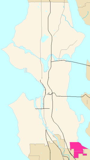
Rainier Beach and Rainier View Highlighted in Pink
|
|
| Country | United States |
| State | Washington |
| County | King |
| City | Seattle |
| ZIP Code |
98118
|
| Area Code | 206 |
Rainier Beach is a group of neighborhoods in Seattle, Washington. It's mostly a place where people live. Sometimes it's also called Atlantic City. It includes areas like Dunlap, Pritchard Island, and Rainier View.
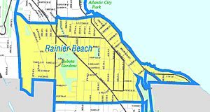
You can find Rainier Beach in the southeast part of Seattle, right next to Lake Washington. The main roads here are Rainier Avenue South and Renton Avenue South.
The exact borders of neighborhoods in Seattle can be a bit tricky. Rainier Beach connects with the Dunlap neighborhood (also known as Othello) to the north. To the east is Lake Washington, and to the west is the South Beacon Hill neighborhood. South of Rainier Beach is Rainier View. Beyond Rainier View are other areas like Lakeridge and Skyway, and the city of Tukwila.
Contents
Discovering Rainier Beach History
This area, now known as Rainier Beach, has been home to people for a very long time. People lived here since the end of the last Ice Age, about 8,000 years before Christ. The Xacuabš (Lake People) tribe lived here. They were related to the Dkhw'Duw'Absh tribe, who lived by Elliott Bay. Both tribes are now part of the Duwamish tribe.
The Xacuabš had a village called tleelh-chus (little island). It was on an island near Lake Washington. A trail from their village led to the Dkhw'Duw'Absh villages. In 1855, the Duwamish people lost their land due to the Treaty of Point Elliott.
How Rainier Beach Grew
The old trail became a path for moving farm animals in the 1870s. The valley was renamed Rainier Valley. The island became Young's Island in 1883, then Pritchard Island in 1900. The trail later became a railway route in 1894. This railway was replaced by Rainier Avenue South in 1937. This road was the main route to Renton until a new floating bridge opened in 1940.
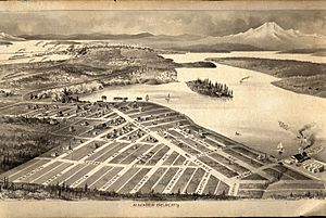
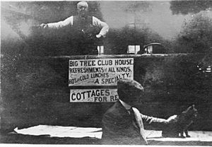
An electric trolley line reached the Rainier Valley in 1891. This led to more homes being built. A person named Clarence Dayton Hillman started a housing development called Atlantic City in 1905. He named it after the famous resort in New Jersey. He created a park with a pier, bath house, and picnic areas. He sold land to many eager buyers. The park area was later returned to public use around 1912. The interurban railway stayed until 1936, then it was removed for cars.
Historic Buildings in Rainier Beach
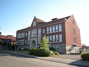
Two important historic buildings still stand today. Emerson School, built in 1909, is a landmark. It looks like Hawthorne and Greenwood schools, built at the same time. They are all made of brick in a special style. Seattle's first public Kindergarten opened at Emerson School in 1914. A famous student from Emerson was Fred Hutchinson, a professional baseball player. The Fred Hutchinson Cancer Research Center is named after him.
Firehouse #33, built in 1914, is also a historic landmark. It was made for a single horse-drawn fire engine. The building's style fit into the Lakeridge neighborhood. The part of the building that held the fire hoses was built into the ground. The floor for the horses was sloped to help them start quickly when an alarm sounded.
Rainier Beach became part of Seattle in 1907. In 1917, the level of Lake Washington dropped by about 9 feet (2.7 meters). This happened when the US Army Corps of Engineers built the Lake Washington Ship Canal. Pritchard Island, which was once a small island, became a peninsula. After World War II, the area became more urban.
In the 1950s, the lake's water quality got very bad. But in the 1960s, a big cleanup effort helped the neighborhood greatly. More African-American people have moved to Rainier Beach over time. This is partly because housing costs in other Seattle neighborhoods have gone up. Today, Rainier Beach has a population of 6,006 people. About 55% are African American, 20% Asian, 10% Caucasian, 10% Hispanic, and 5% from other backgrounds. It is one of the few neighborhoods in Seattle where Black people are the majority.
Parks and Green Spaces
Rainier Beach has several great public spaces. These include Beer Sheva Park (also known as Atlantic City Park), the Atlantic City Boat Ramp, Kubota Garden Park, Lakeridge Park, Fred Hutchinson Playground, and Deadhorse Canyon Natural Area.
Lakeridge Park protects 35.8 acres (14.5 hectares) of Taylor Creek and Deadhorse Canyon. This area was too steep for houses in the 1800s. Green spaces in cities need a lot of care to survive. Local groups of volunteers work with the city to protect these areas. They help educate people and clean up the parks.
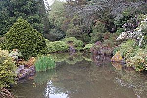
Kubota Garden Park
Mapes Creek flows from a ridge in Rainier Beach through the Kubota Garden and Beer Sheva Park to Lake Washington. The garden is a historic landmark since 1981. The creek was mostly saved from city growth because it was far away. Also, Fujitaro Kubota, a master gardener, worked to protect it from 1927 until his death in 1973. His family continued his efforts.
The city bought about 17 acres (6.9 hectares) of land next to the garden to keep it natural. This protects about 21.5 acres (8.7 hectares) of Mapes Creek. The Kubota Garden Foundation, a non-profit group, helps take care of the garden. They want to keep Mr. Kubota's vision alive. They also teach people about Japanese gardening and its ideas.
Taylor Creek and Deadhorse Canyon
Taylor Creek flows from Deadhorse Canyon through Lakeridge Park to Lake Washington. Volunteers have been working to restore this area since 1971. They have planted thousands of native trees and plants. They have also removed tons of trash and harmful plants. The city has helped by removing barriers that blocked fish and by improving trails.
Healthy city streams need constant care from the people who live nearby. In cities, most natural ground is covered by buildings and roads. This means a lot of rainwater flows quickly into creeks, carrying pollution. Solutions need to include the whole area around the creek, not just the creek itself. Animals like deer, raccoons, opossums, and many birds have been seen here. By about 2050, the area should look like a younger version of how it was before people changed it. Taylor Creek is one of the four largest streams in Seattle. In 2010, Seattle started a project to help fish move better along the creek.
Local Schools
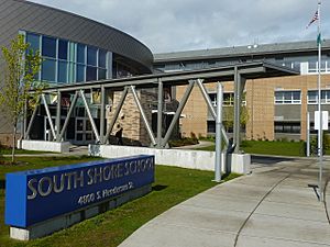
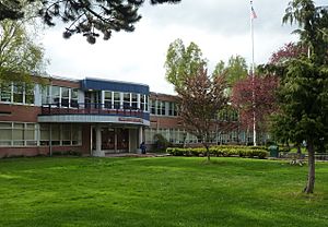
The schools in this area include Rainier Beach High School and South Shore School.
Getting Around Rainier Beach
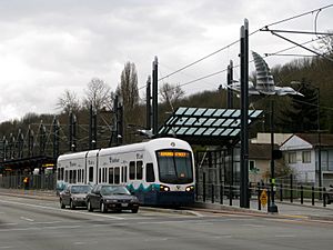
Rainier Beach has a Sound Transit Link light rail station called the Rainier Beach station. This station connects Rainier Beach to Downtown Seattle, Capitol Hill, and the University of Washington to the north. It also goes south to the Seattle–Tacoma International Airport.
King County Metro also provides bus services in the Rainier Beach area. Here are some of the main bus routes:
| 7 | Goes to Downtown Seattle, International District, Rainier Valley, Columbia City, and Rainier Beach. |
| 8 | Connects Rainier Beach, Central District, Capitol Hill, and Seattle Center. |
| 9 | Travels between Capitol Hill, Broadway, Seattle Central Community College, First Hill, Rainier Valley, Columbia City, and Rainier Beach. |
| 106 | Goes through the Tunnel, Downtown Seattle, SODO, Rainier Beach, Skyway, and Renton Transit Center. |
| 107 | Connects Rainier Beach, Rainier View, Lake Ridge, Bryn Mawr, and Renton Transit Center. |
| 36 | Goes to Downtown Seattle, Pacific Medical Center, Beacon Hill, Jefferson Park, VA Hospital, and Othello Station. |
| 50 | Connects Othello Station, Columbia City, Beacon Hill, SODO, West Seattle, and Alki. |


