Quick facts for kids
Rangitoto Islands
| Geography |
| Location |
Marlborough Region |
| Coordinates |
40°46′03″S 173°58′56″E / 40.7674°S 173.9822°E / -40.7674; 173.9822 |
| Highest elevation |
225 m (738 ft) |
| Administration |
|
|
| Demographics |
| Population |
0 |
The Rangitoto Islands are a small group of islands located in New Zealand. You can find them near the Marlborough Sounds, which is a beautiful area along the northern coast of the South Island. These islands are known for their natural beauty and interesting history.

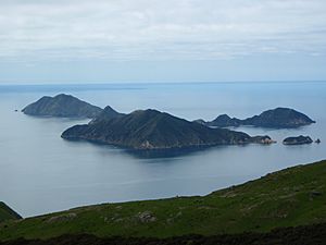
Rangitoto Islands as seen from D'Urville Island
Discovering the Rangitoto Islands
The Rangitoto Islands are a cluster of land masses in the Marlborough Region. They are part of the many islands that make up New Zealand's stunning coastline. These islands are a great example of the country's unique geography.
What Islands Make Up the Group?
The Rangitoto group includes three main islands. Each one has its own special features.
- Wakaterepapanui Island is the tallest, reaching about 225 m (738 ft) high.
- Tinui Island is a bit smaller, standing at about 190 m (620 ft) high.
- Puangiangi Island is the lowest of the three, with a height of around 150 m (490 ft).

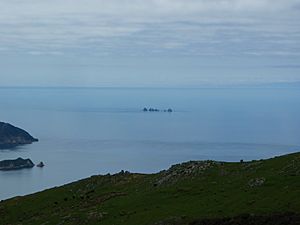
Jag Rocks (Central) to the east of Rangitoto Islands
Who Lived on Puangiangi Island?
For many years, Puangiangi Island had a unique resident. Starting in 1957, a man named Ross Webber lived there all by himself. He was the only person on the island for a long time. Recently, he decided to sell the island. This makes Puangiangi Island a special place with a story of solitary living.


