Rangitoto Island facts for kids
|
Ngā Rangi-i-totongia-a Tama-te-kapua (Māori)
|
|
|---|---|
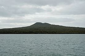
Rangitoto Island viewed from the southwest
|
|
| Geography | |
| Location | Auckland |
| Coordinates | 36°47′12″S 174°51′36″E / 36.786742°S 174.860115°E |
| Highest point | 260 m (850 ft) |
| Administration | |
|
New Zealand
|
|
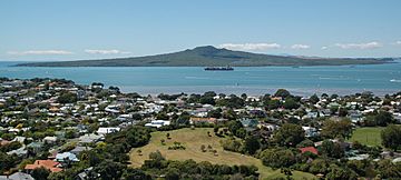
Rangitoto Island is a special volcanic island in the Hauraki Gulf near Auckland, New Zealand. It looks like a perfect cone and is 5.5 km (3.4 mi) wide. The island reaches a height of 260 m (850 ft).
Rangitoto is the youngest and largest of about 50 volcanoes in the Auckland volcanic field. It formed from an eruption around 600 years ago. The island covers an area of 2,311 ha (5,710 acres). It is separated from Auckland's North Shore by the Rangitoto Channel. Since World War II, a road has connected it to Motutapu Island, which is much older and not volcanic.
The name Rangitoto means 'Bloody Sky' in the Māori language. This name comes from a longer phrase: Ngā Rangi-i-totongia-a Tama-te-kapua. This phrase means "The days of the bleeding of Tama-te-kapua." Tama-te-kapua was the captain of the Arawa waka (canoe). He was badly hurt on the island after losing a battle with the Tainui iwi (tribe) at Islington Bay.
Contents
How Rangitoto Island Was Formed
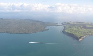
Rangitoto Island was created by a single period of eruptions. This period might have lasted only 5 to 10 years, about 600 years ago. Earlier ideas suggested it formed over thousands of years, but new studies have changed this view.
The first part of the eruption was wet. It produced a lot of volcanic ash that covered nearby Motutapu Island. Later, the eruption became dry. This dry eruption built most of Rangitoto, creating all the lava flows and the cone at the top. The volcano erupted about 2.3 km3 (0.55 cu mi) of material. This amount was roughly equal to all the material from all other eruptions in the Auckland volcanic field combined, which happened over more than 200,000 years.
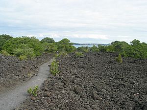
As the volcano cooled, the ground around the crater sank a little. This created a moat-like ring around the top. You can see this from a path that goes around the rim and up to the highest point. In some areas, you can see fields of black, clinker-like lava stones. They look very new.
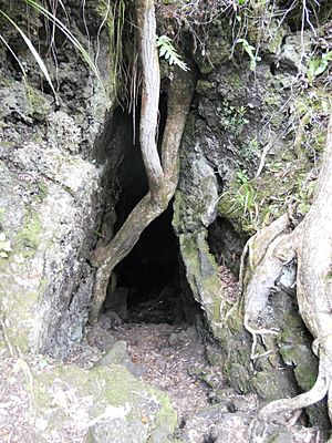
About 200 meters from the top, on the eastern side, you can walk through some lava tubes. These are like caves left behind when liquid lava flowed through. The easier caves to find are marked with signs. Lava tubes form when hot, runny lava cools on the outside. This forms a hard crust, while the liquid lava inside keeps flowing. At Rangitoto, these tubes are large and feel like caves. You will need a torch to explore them. The longest known cave is about 50 meters long.
Plants and Animals on Rangitoto
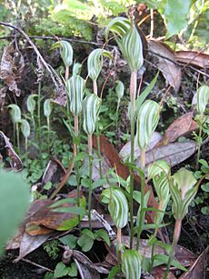
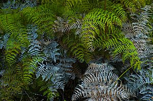
Rangitoto Island has almost no streams, so its plants get all their water from rainfall. The island has the world's largest forest of pohutukawa trees. It also has many northern rata trees. In total, over 200 types of trees and flowers grow here. These include several kinds of orchids and more than 40 types of ferns. The way plants grow here is affected by the lava flows. Pohutukawa trees often grow in the cracks of the lava.
The island is very important because you can see all stages of plant growth here. You can see bare lava fields, then scrub starting to grow, and finally young forests. Since lava fields don't have normal soil, windblown material and slow breakdown of plants are still changing the island. This makes it more suitable for most plants to grow. This is why the forests are quite young and don't yet have many birds. However, the kaka, a native New Zealand parrot, is believed to have lived on the island before Europeans arrived.
In the mid-1800s, many goats lived on Rangitoto. They were gone by the 1880s. Fallow deer were brought to Motutapu in 1862 and spread to Rangitoto. But they disappeared by the 1980s. The brush-tailed rock-wallaby was brought to Motutapu in 1873. By 1912, it was common on Rangitoto. The brushtail possum was introduced in 1931 and again in 1946. Both wallabies and possums were removed in a special effort from 1990 to 1996.
Other pests like Stoats, rabbits, mice, rats, cats, and hedgehogs were still a problem. The Department of Conservation (DOC) worked to remove them. In August 2011, both Rangitoto and Motutapu Islands were officially declared pest-free. Now, both islands have new populations of North Island saddlebacks, which are native birds.
Since this area is a DOC reserve, visitors are not allowed to bring dogs or other animals onto the islands. This helps protect the native wildlife.
History of Rangitoto Island
Māori Connections
The volcano erupted when local Māori iwi (tribes) remembered it happening. Human footprints have been found in volcanic ash layers on nearby Motutapu Island. The Ngāi Tai iwi lived on Motutapu. They see both islands as their traditional home. The Ngāti Paoa iwi also has connections to Rangitoto.
There are several Māori myths about the island. One story tells of a 'tupua' couple, who were children of the Fire Gods. After arguing and cursing Mahuika, the fire-goddess, their home on the mainland was destroyed. This happened because Mataoho, the god of earthquakes and eruptions, acted for Mahuika. Lake Pupuke on the North Shore was created in this destruction, while Rangitoto rose from the sea. The mists sometimes seen around Rangitoto are called the tears of the tupua for their lost home.
Since Europeans Arrived
The Crown bought Rangitoto Island for £15 in 1854. This was very early in New Zealand's European settlement. For many years, the island was a source of basalt rock for building in Auckland. In 1890, it was made a recreation reserve. It became a popular place for day trips.
Some building still happened. In 1892, salt works were built on 5 acres (20,000 m2) near Mackenzies Bay. The main wharf and a road to the summit opened in 1897. Another road linking the summit to Islington Bay was ready by 1900. For over 30 years (from 1898 to 1930), scoria rock was dug from near the shore on the west side of Islington Bay. This rock was used as building material for Auckland.
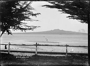
From 1925 to 1936, prison workers built roads on the island and a path to the top. Islington Bay is in the southeast of the island. It was once called Drunks Bay. Sailors who had too much to drink would dry out there before sailing out of the gulf. Today, Auckland boat owners use the bay as a safe place. It is well protected from the usual southwest winds.
During World War II, military buildings were put up. These helped protect Auckland harbour defences. They also housed U.S. troops or stored mines. The most visited remains of these buildings is an old observation post at the summit. The northern shore of the island was used to get rid of unwanted ships. The remains of several wrecks can still be seen at low tide. At least 13 ships were wrecked there from 1887. The last one was the ferry Duchess in June 1947.
Baches (small holiday houses) were built around the island's edge in the 1920s and 1930s. Their legality was questioned from the start. Building more baches was banned in 1937. Most have been removed since then. This is because of the ban and because the island is now a scenic reserve. However, 30 of the original 140 baches remain as of 2010[update]. Some are being kept to show what the island used to be like. It once had a permanent community of hundreds of people, including many children. The buildings included more lasting structures. One was a seawater pool built from quarried stones by prison workers. It is near the current ferry quay.
Visiting Rangitoto Island
You can take regular ferry services and island tours by tractor-trailer. These are provided by Fullers from Auckland city centre. A boardwalk with about 300 steps lets visitors reach the summit. From there, you can enjoy a view of the wooded crater. The walk to the summit is 2.4 km (1.5 mi). It takes about one hour by the most direct path.
If you prefer not to walk, a land train is available. It runs with the ferry times. The train takes visitors to a spot just below the summit. You can also take Sea kayak trips from the mainland to the island.
There are no campsites on Rangitoto Island itself. However, you can camp at Home Bay on the nearby Motutapu Island.
See also
 In Spanish: Rangitoto para niños
 | Precious Adams |
 | Lauren Anderson |
 | Janet Collins |


