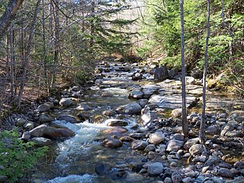
Rattle River facts for kids
Quick facts for kids Rattle River |
|
|---|---|
 |
|
| Country | United States |
| State | New Hampshire |
| County | Coos |
| Town | Shelburne |
| Physical characteristics | |
| Main source | Middle Moriah Mountain White Mountain National Forest 2,770 ft (840 m) 44°21′11″N 71°6′45″W / 44.35306°N 71.11250°W |
| River mouth | Androscoggin River Shelburne 710 ft (220 m) 44°24′18″N 71°6′40″W / 44.40500°N 71.11111°W |
| Length | 4.1 mi (6.6 km) |
The Rattle River is a small river in the White Mountains of New Hampshire, United States. It flows for about 4.1 miles (6.6 kilometers). This river is a "tributary" of the Androscoggin River. A tributary is a smaller stream that flows into a larger one. The Androscoggin River then flows east into Maine, eventually reaching the Atlantic Ocean.
Contents
Exploring the Rattle River
The Rattle River is a short but interesting waterway. It is more like a large brook than a wide river. It plays a small but important part in the local ecosystem.
Where the River Begins
The Rattle River starts high up in the mountains. Its source is in a "saddle" between two mountains. These are Middle Moriah Mountain and Shelburne Moriah Mountain. A saddle is like a low dip or pass between two mountain peaks. This area is located in the town of Shelburne. It is also part of the large White Mountain National Forest.
The River's Journey
From its mountain source, the Rattle River flows north. It travels downhill quite a bit. The river drops from about 2,800 feet (850 meters) above sea level to about 700 feet (210 meters) over its length. This makes for a quick and sometimes "rattling" flow, which might be how it got its name. It finally joins the Androscoggin River in Shelburne.
The Appalachian Trail Connection
A famous hiking path, the Appalachian Trail, follows the Rattle River. Hikers on this long trail walk alongside the river. They can see it from its source all the way to the Androscoggin River valley. This makes the Rattle River a familiar sight for many adventurers.
 | Anna J. Cooper |
 | Mary McLeod Bethune |
 | Lillie Mae Bradford |


