Shelburne, New Hampshire facts for kids
Quick facts for kids
Shelburne, New Hampshire
|
|
|---|---|
|
Town
|
|

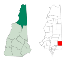
Location in Coös County, New Hampshire
|
|
| Country | United States |
| State | New Hampshire |
| County | Coös |
| Incorporated | 1820 |
| Area | |
| • Total | 48.8 sq mi (126.3 km2) |
| • Land | 47.9 sq mi (124.1 km2) |
| • Water | 0.8 sq mi (2.2 km2) 1.73% |
| Elevation | 715 ft (218 m) |
| Population
(2020)
|
|
| • Total | 353 |
| • Density | 7/sq mi (2.8/km2) |
| Time zone | UTC-5 (Eastern) |
| • Summer (DST) | UTC-4 (Eastern) |
| ZIP code |
03581
|
| Area code(s) | 603 |
| FIPS code | 33-68980 |
| GNIS feature ID | 0873720 |
Shelburne is a small town in New Hampshire, located in the United States. It's found in Coös County. In 2020, about 353 people lived there.
Shelburne is nestled in the beautiful White Mountains. A part of the White Mountain National Forest is in the southern area of the town. You can also find Leadmine State Forest here. The famous Appalachian Trail, a long hiking path, goes right through Shelburne.
The town is also part of the larger Berlin, New Hampshire-Vermont area.
Contents
History
Shelburne was first given its official start in 1769 by Governor John Wentworth. The town was named after William Petty Fitzmaurice, who was an important leader called the Earl of Shelburne.
He supported the American colonies wanting to be independent. Because of him, King George III agreed that the United States could be its own country. People started settling in Shelburne in 1771. The town officially became a town on December 13, 1820. The people of Shelburne voted to keep its name.
In 1781, a group of Native Americans attacked the town. They had also raided other nearby towns. One man was killed, and another was taken captive. The other people living there ran away to a place called Hark Hill for safety. They later found shelter in Fryeburg.
Shelburne had good soil for farming, especially near the Androscoggin River. However, away from the river, the land quickly became mountainous. A railroad, the Atlantic and St. Lawrence Railroad, came through the southern part of town in 1851. This railroad later became known as the Grand Trunk Railway. In 1859, the town had 480 people.
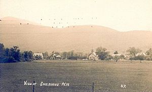
Shelburne is at the northern end of the Mount Washington Valley. It has a lovely group of birch trees. This area is very popular with artists and photographers. It is dedicated to the soldiers from Shelburne who served in World War II.
Geography
Shelburne is located in northern New Hampshire. It sits along the eastern edge of Coos County. The town covers about 126.3 square kilometers (48.8 square miles) in total. Most of this area, about 124.1 square kilometers (47.9 square miles), is land. The rest, 2.2 square kilometers (0.8 square miles), is water.
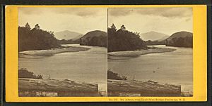
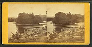
The Androscoggin River flows through Shelburne. Part of the Mahoosuc Range of mountains is in the north. The northern end of the Carter-Moriah Range is to the south. The highest point in Shelburne is about 1,210 meters (3,970 feet) above sea level. This spot is very close to the top of Mount Moriah.
U.S. Route 2 is a main road that goes through the town.
Adjacent municipalities
- Success (north)
- North Oxford, Maine (northeast)
- Gilead, Maine (east)
- South Oxford, Maine (southeast)
- Bean's Purchase (south)
- Gorham (west)
Who Lives in Shelburne?
| Historical population | |||
|---|---|---|---|
| Census | Pop. | %± | |
| 1790 | 31 | — | |
| 1800 | 45 | 45.2% | |
| 1810 | 176 | 291.1% | |
| 1820 | 205 | 16.5% | |
| 1830 | 312 | 52.2% | |
| 1840 | 350 | 12.2% | |
| 1850 | 480 | 37.1% | |
| 1860 | 318 | −33.7% | |
| 1870 | 259 | −18.6% | |
| 1880 | 252 | −2.7% | |
| 1890 | 336 | 33.3% | |
| 1900 | 283 | −15.8% | |
| 1910 | 305 | 7.8% | |
| 1920 | 178 | −41.6% | |
| 1930 | 196 | 10.1% | |
| 1940 | 190 | −3.1% | |
| 1950 | 184 | −3.2% | |
| 1960 | 226 | 22.8% | |
| 1970 | 199 | −11.9% | |
| 1980 | 318 | 59.8% | |
| 1990 | 437 | 37.4% | |
| 2000 | 379 | −13.3% | |
| 2010 | 372 | −1.8% | |
| 2020 | 353 | −5.1% | |
| U.S. Decennial Census | |||
In 2000, there were 379 people living in Shelburne. These people made up 156 households, with 114 of them being families. The town had about 7.9 people per square mile. Most of the people living in Shelburne were White (97.36%). A small number were Native American, Asian, or from other backgrounds. About 1% of the population was Hispanic or Latino.
About 31.4% of the households had children under 18 living with them. Most households (67.9%) were married couples living together. The average household had about 2.43 people. The average family had about 2.85 people.

The people in Shelburne were of different ages. About 23.5% were under 18. About 34.3% were between 45 and 64 years old. The average age in the town was 45 years. For every 100 females, there were about 106 males.
In 2000, the average income for a household in Shelburne was $44,375 per year. For families, the average income was $59,375. The average income for each person in the town was $24,899. A small number of families (2.9%) and people (3.7%) lived below the poverty line. This included 13.5% of people aged 65 or older.
Famous People from Shelburne
- Matt Bevin (born 1967), a businessperson who was the governor of Kentucky from 2015 to 2019.
- John M. Philbrook (1840–1923), a lawmaker from Maine.
- Anne Whitney (1821–1915), an American sculptor and poet.
See also
 In Spanish: Shelburne (Nuevo Hampshire) para niños
 | George Robert Carruthers |
 | Patricia Bath |
 | Jan Ernst Matzeliger |
 | Alexander Miles |


