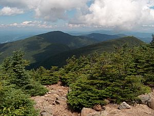
Carter-Moriah Range facts for kids

The Carter-Moriah Range is a group of mountains located in the White Mountains of New Hampshire. You can find it in Coos County. This mountain range sits on the northeast side of Pinkham Notch. It's directly across from the northern part of the Presidential Range, which is another well-known mountain group. Sometimes people just call it the Carter Range.
Tall Peaks of the Range
The Carter-Moriah Range has several important mountain peaks. Here are some of the main ones, listed from north to south:
- Shelburne Moriah Mountain (1,138 meters or 3,735 feet)
- Middle Moriah Mountain (1,145 meters or 3,755 feet)
- Mount Moriah (1,234 meters or 4,049 feet)
- Imp Mountain (1,134 meters or 3,720 feet)
- North Carter Mountain (1,381 meters or 4,530 feet)
- Middle Carter Mountain (1,741 meters or 4,600 feet)
- South Carter Mountain (1,741 meters or 4,420 feet)
- Mount Hight (1,425 meters or 4,675 feet)
- Carter Dome (1,473 meters or 4,832 feet)
Even though it's not officially part of this range, Wildcat Mountain (1,345 meters or 4,422 feet) is nearby. It stands southwest of Carter Dome, across Carter Notch.
Some of the peaks in this range are part of a special list. The Appalachian Mountain Club keeps a list of "Four-thousand footers" in New Hampshire. These are mountains that are at least 4,000 feet (about 1,219 meters) tall.
To be on this list, a mountain also needs to stand out enough from its neighbors. This means it must have enough "topographic prominence." This term means how much a peak rises above the lowest point connecting it to a higher peak. Some peaks in the Carter-Moriah Range are on this list, while others are not. This is either because they are not tall enough or because they don't stand out enough from other nearby mountains.
Where the Water Flows
The water from the Carter-Moriah Range flows in two main directions. To the northwest, the water drains into the Peabody River. To the southeast, it flows into the Wild River.
Both of these rivers eventually join the Androscoggin River. The Peabody River meets the Androscoggin near Gorham, New Hampshire. The Wild River joins it near Gilead, Maine. From there, the Androscoggin River continues its journey until it reaches the Atlantic Ocean on the coast of Maine. So, all the rain and snow that falls on these mountains eventually makes its way to the ocean!
 | Ernest Everett Just |
 | Mary Jackson |
 | Emmett Chappelle |
 | Marie Maynard Daly |

