Carter Dome facts for kids
Quick facts for kids Carter Dome |
|
|---|---|

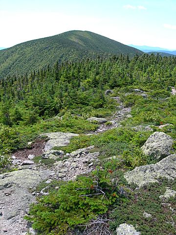
Carter Dome seen from Mt. Hight
|
|
| Highest point | |
| Elevation | 4,832 ft (1,473 m) |
| Prominence | 2,821 ft (860 m) |
| Listing | White Mountain 4000-Footers #12 New England 5 Finest |
| Geography | |
| Location | Coös County, New Hampshire, U.S. |
| Parent range | Carter-Moriah Range |
| Topo map | USGS Carter Dome |
Carter Dome, also known as The Dome, is a cool mountain found in Coös County, New Hampshire. It's part of the Carter-Moriah Range, which is a section of the famous White Mountains. This range stretches along the northern side of Pinkham Notch.
Carter Dome has some mountain neighbors! To its northeast, you'll find Mount Hight. To its southwest, across Carter Notch, is Wildcat Mountain.
What's in a Name?
Have you ever wondered how places get their names? The exact reason for Carter Dome's name is a bit of a mystery! Some local stories say it was named after a hunter called Carter. The same stories suggest that a nearby peak, Mount Hight, was named after his hunting partner. It's fun to imagine these two explorers giving names to the mountains they discovered!
How to Explore Carter Dome
If you love hiking, Carter Dome is a great place to visit! There are a few trails that lead to the top.
- From the west, you can use the Carter Dome Trail.
- Also from the west, the Nineteen Mile Brook Trail is another option.
- If you're coming from the east, the Black Angel Trail will take you there.
These trails offer amazing views and a chance to experience the beauty of the White Mountains firsthand. Remember to always be prepared and safe when hiking!
 | Sharif Bey |
 | Hale Woodruff |
 | Richmond Barthé |
 | Purvis Young |

