Retalhuleu facts for kids
Quick facts for kids
Retalhuleu
|
|
|---|---|
|
Municipality and city
|
|
| Country | |
| Department | |
| Area | |
| • Municipality and city | 305 sq mi (791 km2) |
| Elevation | 761 ft (232 m) |
| Population
(2018 census)
|
|
| • Municipality and city | 90,505 |
| • Density | 296.34/sq mi (114.42/km2) |
| • Urban | 90,505 |
| Climate | Am |
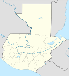
The city of Retalhuleu (pronounced ret-ah-loo-LEW) is in the southwestern part of Guatemala. It is the main city of the Retalhuleu region. People who live there often call it "Reu" for short.
Retalhuleu is about 240 meters (787 feet) above sea level. In 2018, the city had a population of 90,505 people.
Contents
History of Retalhuleu
Retalhuleu has an interesting past. It was once home to a secret training camp.
Training Camp and Airfield
In 1960, a secret training camp was set up near Retalhuleu. It was on a coffee farm called Helvetia. People were trained there for a special mission. An airfield, also known as Rayo Base, was built nearby in November 1960.
Helping During a Rebellion
Later in 1960, the people trained at Retalhuleu also helped stop a rebellion by some officers in Guatemala. The U.S. Navy also helped.
Recent Weather Event
In August 2021, Retalhuleu had very heavy rain for 36 hours. This caused landslides and floods, damaging the city and other places in Guatemala.
Sports in Retalhuleu
If you like soccer, you'll be interested to know that Retalhuleu has its own team!
Deportivo Reu Soccer Team
The local soccer team is called Deportivo Reu. It was started in 2013. They play their home games at the Estadio Dr. Óscar Monterroso Izaguirre stadium.
Climate in Retalhuleu
Retalhuleu has a tropical monsoon climate. This means it has two main seasons:
- A very rainy season from April to November.
- A dry season from December to March.
| Climate data for Retalhuleu (1991–2020) | |||||||||||||
|---|---|---|---|---|---|---|---|---|---|---|---|---|---|
| Month | Jan | Feb | Mar | Apr | May | Jun | Jul | Aug | Sep | Oct | Nov | Dec | Year |
| Record high °C (°F) | 35.8 (96.4) |
37.4 (99.3) |
36.6 (97.9) |
38.0 (100.4) |
37.0 (98.6) |
35.6 (96.1) |
35.8 (96.4) |
36.0 (96.8) |
35.0 (95.0) |
34.3 (93.7) |
36.4 (97.5) |
35.0 (95.0) |
38.0 (100.4) |
| Mean daily maximum °C (°F) | 33.3 (91.9) |
33.5 (92.3) |
33.8 (92.8) |
34.0 (93.2) |
33.2 (91.8) |
32.5 (90.5) |
32.8 (91.0) |
32.9 (91.2) |
32.5 (90.5) |
32.3 (90.1) |
32.8 (91.0) |
33.2 (91.8) |
33.1 (91.6) |
| Daily mean °C (°F) | 27.1 (80.8) |
27.7 (81.9) |
28.3 (82.9) |
28.7 (83.7) |
28.0 (82.4) |
27.2 (81.0) |
27.3 (81.1) |
27.3 (81.1) |
26.6 (79.9) |
26.6 (79.9) |
27.0 (80.6) |
27.0 (80.6) |
27.4 (81.3) |
| Mean daily minimum °C (°F) | 20.7 (69.3) |
21.0 (69.8) |
21.6 (70.9) |
22.4 (72.3) |
22.5 (72.5) |
22.3 (72.1) |
22.0 (71.6) |
22.1 (71.8) |
22.0 (71.6) |
21.9 (71.4) |
21.5 (70.7) |
21.0 (69.8) |
21.8 (71.2) |
| Record low °C (°F) | 18.0 (64.4) |
18.3 (64.9) |
18.0 (64.4) |
19.9 (67.8) |
19.6 (67.3) |
20.0 (68.0) |
19.0 (66.2) |
18.5 (65.3) |
20.4 (68.7) |
19.6 (67.3) |
18.9 (66.0) |
17.7 (63.9) |
17.7 (63.9) |
| Average precipitation mm (inches) | 11.4 (0.45) |
11.0 (0.43) |
38.8 (1.53) |
143.0 (5.63) |
452.6 (17.82) |
476.4 (18.76) |
343.5 (13.52) |
395.9 (15.59) |
527.0 (20.75) |
503.3 (19.81) |
144.4 (5.69) |
37.9 (1.49) |
3,085.2 (121.46) |
| Average precipitation days (≥ 1.0 mm) | 1.2 | 1.1 | 3.4 | 8.4 | 18.8 | 20.1 | 19.3 | 20.0 | 22.9 | 20.8 | 8.1 | 2.2 | 146.3 |
| Source: NOAA | |||||||||||||
More About Retalhuleu
- You can find a map of Retalhuleu here: Map of Retalhuleu
See also
 In Spanish: Retalhuléu (municipio) para niños
 | Valerie Thomas |
 | Frederick McKinley Jones |
 | George Edward Alcorn Jr. |
 | Thomas Mensah |


