
River Ryburn facts for kids
Quick facts for kids River Ryburn |
|
|---|---|

River Ryburn With Slitheroe Bridge hidden in the trees, this bridge carries the A672 over the river.
53°39′55.77″N 1°56′56.8″W / 53.6654917°N 1.949111°W |
|
| Country | England |
| Physical characteristics | |
| Main source | Confluence of unnamed stream and Black Castle Clough nr Rishworth 361 metres (1,184 ft) 53°39′35″N 2°1′29″W / 53.65972°N 2.02472°W |
| River mouth | River Calder at Sowerby Bridge 80 metres (260 ft) 53°42′28″N 1°54′42″W / 53.70778°N 1.91167°W |
| Length | 11.4 kilometres (7.1 mi) |
| Basin features | |
| Basin size | 13 square kilometres (5.0 sq mi) |
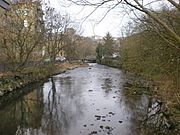
The River Ryburn is a cool river in West Yorkshire, England. It flows through some lovely villages like Rishworth, Ripponden, and Triangle. Eventually, it joins up with the bigger River Calder in a town called Sowerby Bridge.
Contents
Where the River Ryburn Begins and Ends
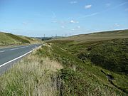
The River Ryburn officially starts where a small unnamed stream meets Black Castle Clough. This spot is just east of the Blackstone Edge Reservoir. From there, the river flows east, running alongside the A58 Rochdale Road.
It then flows into Baitings Reservoir. After a short journey out of Baitings, it flows into Ryburn Reservoir. The river leaves Ryburn Reservoir just north of Rishworth village.
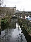
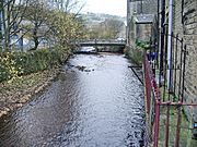
Next, it turns northeast and flows through the town of Ripponden. After leaving Ripponden, it heads north towards Triangle. Finally, it turns northeast again, flowing through Sowerby Bridge before joining the River Calder.
A Look Back in Time: History of the River
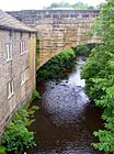
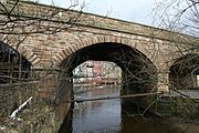
The area around the River Ryburn has a long history. One interesting spot is the bridge on the B6113, Elland Road, in Ripponden. This bridge was part of the Elland Turnpike in 1815. A turnpike was an old road where you had to pay a toll to use it.
This bridge was first built way back in 1772. It was later made wider and changed in the 1800s. Right next to it, you can see the original Ripponden Old Bridge. This older bridge has been around since at least 1313!
The Baitings and Ryburn reservoirs were built to supply water to Wakefield Corporation. Baitings Reservoir took eight years to build and opened on November 14, 1956. It cost about £1.4 million. This reservoir is 64 acres big and can hold 775 million gallons of water. It reaches a depth of 155 feet (47 m).
The dam at the east end of Baitings Reservoir is 1,550 feet (470 m) wide and 185 feet (56 m) high. When the water levels are low, you can sometimes see an old road and bridge that were submerged when the reservoir was filled.
Ryburn Reservoir was opened earlier, on September 7, 1933. It also took eight years to build and cost £240,000. Its dam is about 100 feet (30 m) high. This reservoir holds 220 million gallons of water and covers 26 acres. It even covers the old village of Bogden, which is now underwater!
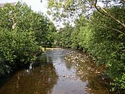
A local landowner named John Rawson (who lived from 1813 to 1899) was responsible for planting many of the trees and woodlands you see along the River Ryburn valley today.
Places and Bridges Along the River
Towns and Villages
|
Bridges and Crossings
|
Pictures of the River Ryburn
- Along the River Ryburn
-
The A58 and the River Ryburn, Soyland
-
Elland Road Bridge, Ripponden.
-
River Ryburn from the footbridge at Kebroyd
-
River Ryburn with Asquith Bottom Mills in the background
-
River Ryburn looking downstream from Stirk Bridge
-
River Ryburn in Sowerby Bridge
-
River Ryburn, Sowerby Bridge
-
Railway bridge over the River Ryburn, Sowerby Bridge


